File:Karte Herzogtum Bayern im 10. Jahrhundert.png - Wikipedia
 Article Images

Original file (2,844 × 3,008 pixels, file size: 13.67 MB, MIME type: image/png)
File history
Click on a date/time to view the file as it appeared at that time.
| Date/Time | Thumbnail | Dimensions | User | Comment | |
|---|---|---|---|---|---|
| current | 07:53, 13 June 2020 | | 2,844 × 3,008 (13.67 MB) | Chumwa | corr |
| 04:14, 10 June 2015 |  | 2,844 × 3,008 (13.67 MB) | Chumwa | ||
| 07:31, 6 June 2015 |  | 2,844 × 3,008 (13.66 MB) | Chumwa | Hervorhebung andersherum | |
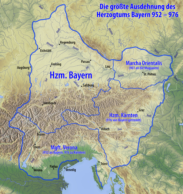
| 07:19, 6 June 2015 |  | 2,844 × 3,008 (13.07 MB) | Chumwa | {{Information |Description= {{de|Karte des Herzogtums Bayern im 10. Jahrhundert}} |Source={{Own}}, using * information from this map by {{U|Electionworld}} * map data from [http://www.maps-for-free.com/ maps-for-free.com]... |
File usage
The following 11 pages use this file:
Global file usage
This file contains additional information, probably added from the digital camera or scanner used to create or digitize it.
If the file has been modified from its original state, some details may not fully reflect the modified file.
| Horizontal resolution | 28.35 dpc |
|---|---|
| Vertical resolution | 28.35 dpc |
| Software used |