File:Pyrenees topographic map-en.svg - Wikipedia
 Article Images

Original file (SVG file, nominally 3,200 × 1,900 pixels, file size: 6.3 MB)
File history
Click on a date/time to view the file as it appeared at that time.
| Date/Time | Thumbnail | Dimensions | User | Comment | |
|---|---|---|---|---|---|
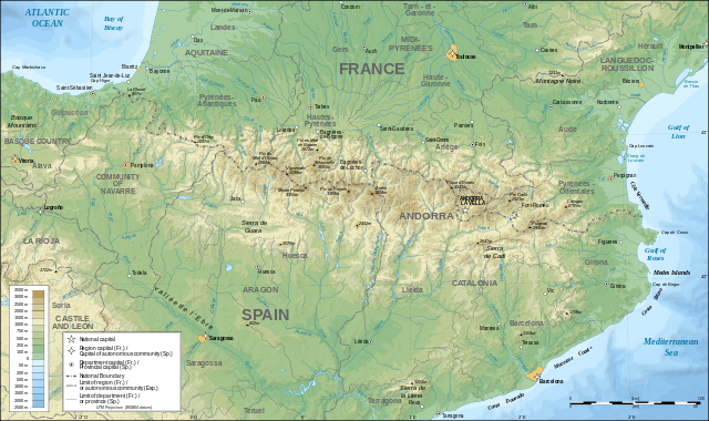
| current | 00:25, 28 May 2011 | | 3,200 × 1,900 (6.3 MB) | RedWolf | {{Information |Description={{en|Topographic map in English of the Pyrenees mountains.<br/>''Note:'' The shaded relief is a raster image embedded in the SVG file.}} {{fr|Carte topographique des Pyrénées en english.<br/ |
File usage
More than 100 pages use this file. The following list shows the first 100 pages that use this file only. A full list is available.
View more links to this file.
Global file usage
This file contains additional information, probably added from the digital camera or scanner used to create or digitize it.
If the file has been modified from its original state, some details may not fully reflect the modified file.
| Width | 3200 |
|---|---|
| Height | 1900 |