Category:Locator maps of India - Wikimedia Commons
Media in category "Locator maps of India"
The following 81 files are in this category, out of 81 total.
-
Indiastates&utnumbered 2.PNG 1,000 × 1,138; 135 KB
-

India states and union territories map mr.png 1,664 × 1,873; 447 KB
-

India-states-numbered-bn.png 1,594 × 1,868; 605 KB
-
India-states-numbered-bn.svg 1,594 × 1,868; 320 KB
-

100px-Topographic30deg N0E60-T-PA.jpg 100 × 100; 17 KB
-

1947-Khasi states.png 636 × 456; 13 KB
-

Bundelkhand.svg 512 × 578; 548 KB
-

Chickensneckindia.jpg 474 × 547; 89 KB
-

East-India-locator1.png 514 × 600; 68 KB
-

Eastindiamap.png 624 × 704; 27 KB
-

Hindu temples map.svg 1,639 × 1,852; 374 KB
-

India & Mali Locations - PNG file.png 477 × 250; 54 KB
-

India & Mali Locations.jpg 477 × 250; 56 KB
-
India (orthographic projection).png 2,000 × 2,000; 658 KB
-

India - Location Map (2013) - IND - UNOCHA.svg 250 × 250; 554 KB
-

India Administrative Divisions 1951.svg 851 × 1,188; 1.86 MB
-

India Awadh locator map.svg 1,639 × 1,852; 795 KB
-

India Bagelkhand locator map.svg 1,639 × 1,852; 795 KB
-

India Bodoland locator map.png 1,086 × 1,200; 295 KB
-

India Bundelkhand locator map.svg 1,639 × 1,852; 795 KB
-
India Carnatic locator map.svg 1,639 × 1,852; 795 KB
-

India Chola Nadu locator map.svg 1,639 × 1,852; 795 KB
-

India Circar locator map.svg 1,639 × 1,852; 795 KB
-

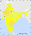
India decadal growth rate map.svg 1,639 × 1,852; 805 KB
-

India Dhundhar locator map.svg 1,639 × 1,852; 795 KB
-

India earthquake zone map.svg 1,639 × 1,852; 259 KB
-

India Godwar locator map.svg 1,639 × 1,852; 795 KB
-

India Hadoti locator map.svg 1,639 × 1,852; 795 KB
-

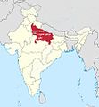
India Harit Pradesh locator map.svg 1,639 × 1,852; 795 KB
-

India Khandesh locator map.svg 1,639 × 1,852; 795 KB
-

India Kongu Nadu locator map.svg 1,639 × 1,852; 795 KB
-

India Konkan locator map.svg 1,639 × 1,852; 795 KB
-
India Malabar locator map.svg 1,639 × 1,852; 795 KB
-

-

India Marathwada locator map.svg 1,639 × 1,852; 795 KB
-

India Maroth (orthographic projection).gif 541 × 541; 52 KB
-

India Marwar locator map.svg 1,639 × 1,852; 795 KB
-

India Pandya Nadu locator map.svg 1,639 × 1,852; 795 KB
-
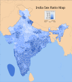
India sex ratio map.svg 1,639 × 1,852; 802 KB
-

India Shekhawati locator map.svg 1,639 × 1,852; 795 KB
-

India Sikkim locator map.png 543 × 600; 144 KB
-
India Uttaranchal locator map.svg 1,639 × 1,852; 751 KB
-

India Vagad locator map.svg 1,639 × 1,852; 795 KB
-
India Venad locator map.svg 1,639 × 1,852; 795 KB
-
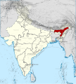
India, Assam locator map (2015).svg 600 × 666; 6.94 MB
-

India, Mizoram locator map (2015.04.21).svg 600 × 666; 7.81 MB
-

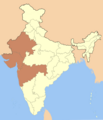
India, Uttar Pradesh locator map (2015).svg 600 × 666; 7.8 MB
-

India-Map-NP-S-East.png 1,486 × 1,734; 265 KB
-

India-Map-NP-S-Middle.png 1,486 × 1,734; 265 KB
-

India-Map-NP-S-North.png 1,486 × 1,734; 261 KB
-

India-Map-NP-S-South.png 1,486 × 1,734; 264 KB
-
India-Map-NP-S-West.png 1,486 × 1,734; 265 KB
-
India-roma.png 527 × 599; 97 KB
-

India-states-numbered.svg 1,594 × 1,868; 306 KB
-

India-states.gif 625 × 704; 216 KB
-

India-sunanda-devi.jpg 569 × 612; 302 KB
-

Indiaindex.jpg 650 × 790; 79 KB
-

IndiaOnWorldMap.png 1,427 × 628; 46 KB
-

Indiastates&utnumbered 2 de.PNG 1,000 × 1,138; 59 KB
-

Indiastates&utnumbered fr.png 1,000 × 1,138; 165 KB
-

Indiastates&utnumbered.png 1,000 × 1,138; 175 KB
-

Indie admin1 cs.png 300 × 347; 30 KB
-

Indies by Jaggivasudev.jpg 1,427 × 628; 55 KB
-

Jungle-Book-locator-map.svg 1,486 × 1,734; 340 KB
-

Kanchipuram location.jpg 238 × 279; 9 KB
-

Kashmir conflict disputed territory animation.png 1,000 × 1,000; 247 KB
-

LocationIndia.PNG 1,357 × 628; 24 KB
-

LocationIndia.png 1,357 × 628; 21 KB
-

LocMap of WH Ajanta Caves.png 700 × 650; 9 KB
-

Mapa República de l'Índia.png 626 × 626; 80 KB
-
Muhajir Sooba.jpg 892 × 960; 159 KB
-

North East India.svg 612 × 696; 174 KB
-
North India Zonal Map 14July2013.png 514 × 600; 167 KB
-

North India Zonal Map July2013.png 514 × 600; 167 KB
-
Proposed Barak state map 2.png 1,280 × 1,378; 609 KB
-

Proposed Barak state map.png 1,280 × 1,378; 609 KB
-

Se asia-in.PNG 250 × 201; 5 KB
-

South India 2017 map.jpg 1,594 × 1,868; 151 KB
-

Subdivisió de l'Índia.png 800 × 910; 165 KB
-

World Factbook (1982) India.jpg 588 × 587; 92 KB
-
مہاجر صوبہ، انڈیا.jpg 892 × 960; 158 KB


.png)
_-_IND_-_UNOCHA.svg)


.gif)


.svg)
.svg)
.svg)


_India.jpg)
