Category:SVG maps of India - Wikimedia Commons
Media in category "SVG maps of India"
The following 68 files are in this category, out of 68 total.
-

-

2024 NDA Alliance Lok Sabha Seat Sharing.svg 1,380 × 1,700; 5.76 MB
-

Akhand Bharat location map.svg 2,048 × 2,048; 757 KB
-

Andaman and Nicobar Islands Wikivoyage map.svg 550 × 750; 384 KB
-
Baiga distribution.svg 1,500 × 1,615; 3.14 MB
-

Bharat (India) Map with Full Kashmir By Devilal.svg 512 × 509; 52 KB
-

Bhumij people distribution.svg 1,500 × 1,615; 3.15 MB
-
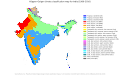
BIMARU.svg 1,643 × 1,856; 837 KB
-

Distribution map of horse breeds in India.svg 1,519 × 1,773; 321 KB
-

Distribution of Bhuiya community in India.svg 1,500 × 1,615; 3.31 MB
-

Distribution of Khond tribe in India.svg 1,500 × 1,615; 3.14 MB
-

Főbb indiai helynevek.svg 1,639 × 1,852; 368 KB
-

Ganesh Chaturthi in India.svg 1,643 × 1,856; 838 KB
-
GST Ratification.svg 1,476 × 1,680; 227 KB
-

Hindu temples map.svg 1,639 × 1,852; 374 KB
-

Ho language distribution map.svg 1,500 × 1,615; 3.15 MB
-

India annual rainfall map en.svg 1,639 × 1,852; 338 KB
-

India annual rainfall map.svg 1,639 × 1,852; 268 KB
-

India average annual temperature map es.svg 1,639 × 1,852; 380 KB
-

India COVID-19 confirmed cases scheme A.svg 512 × 583; 404 KB
-

India cow slaughter map.svg 1,500 × 1,615; 1.37 MB
-
India disputed w1 countrymap.svg 1,000 × 1,000; 57 KB
-

India flood zone map-de.svg 827 × 938; 419 KB
-

India flood zone map.svg 1,639 × 1,852; 383 KB
-

India literacy rate map de.svg 825 × 929; 878 KB
-
India Map Protection.svg 1,594 × 1,868; 225 KB
-

India southwest summer monsoon onset map-es.svg 1,639 × 1,852; 566 KB
-

India southwest summer monsoon onset map-fr.svg 1,639 × 1,852; 621 KB
-

India urbanization rate map.svg 1,500 × 1,615; 1.39 MB
-

India VOA New.svg 512 × 583; 158 KB
-

India wind zone map en.svg 1,639 × 1,852; 349 KB
-

India wind zone map.svg 1,639 × 1,852; 266 KB
-

Indian bases worldwide.svg 863 × 443; 1.21 MB
-

Indian WhatsApp Lynchings (July 2018).svg 1,643 × 1,856; 849 KB
-
Indian world contour.svg 300 × 290; 50 KB
-

Indianrailwayzones-numbered-bn.svg 500 × 563; 98 KB
-
Indianrailwayzones-numbered.svg 500 × 563; 96 KB
-

Islam in India (2011).svg 1,643 × 1,856; 257 KB
-

Jungle-Book-locator-map.svg 1,486 × 1,734; 340 KB
-

Ka-endemicdistrictIndia.svg 1,643 × 1,856; 820 KB
-
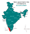
Kerala Flood Relief States.svg 1,594 × 1,772; 310 KB
-

Khortha language distribution.svg 1,500 × 1,615; 3.14 MB
-
Koppen-Geiger Map IND present.svg 1,361 × 850; 2.11 MB
-

Map of Yogini Temples in India.svg 1,293 × 1,420; 296 KB
-

Munda people distribution.svg 1,500 × 1,615; 3.16 MB
-
Naval bases of India as.svg 1,486 × 1,734; 460 KB
-

Naval bases of India-gu.svg 1,486 × 1,734; 325 KB
-

Naval bases of India-hi.svg 1,486 × 1,734; 459 KB
-

Naval bases of India-kn.svg 1,557 × 1,838; 371 KB
-

Naval bases of India-mr.svg 1,486 × 1,734; 481 KB
-
Naval bases of India-pa.svg 1,486 × 1,734; 459 KB
-

Naval bases of India-te.svg 1,486 × 1,734; 460 KB
-
Naval bases of India.svg 1,486 × 1,734; 557 KB
-

Naxal Left-wing violence or activity affected districts of India 2018.svg 1,649 × 1,858; 772 KB
-
Religion in India.svg 1,440 × 1,685; 1.07 MB
-

Sadri (Nagpuria) language distribution map.svg 1,500 × 1,615; 3.14 MB
-
SITE-map-locations.svg 1,486 × 1,734; 450 KB
-

Sivallik Hills map.svg 3,099 × 2,868; 6.99 MB
-
Six regions of India.svg 512 × 583; 156 KB
-
South Asia Rivers.svg 1,639 × 1,852; 581 KB
-
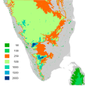
South India altitudes-opt.svg 800 × 807; 2.08 MB
-

South Indian territories de.svg 693 × 748; 697 KB
-
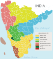
South Indian territories.svg 672 × 746; 306 KB
-
States of India (Survey of India).svg 794 × 1,123; 603 KB
-
Stroke-dasharray chromium bug full.svg 500 × 492; 4.26 MB
-

Territorial waters - India.svg 800 × 400; 528 KB
-
Vice-Presidents of India (by state of birth).svg 1,180 × 1,398; 445 KB
-

কেরল বন্যা ত্রাণকার্যে অবদান রাখা রাজ্যসমূহ.svg 1,594 × 1,772; 581 KB


_Map_with_Full_Kashmir_By_Devilal.svg)


.svg)


.svg)


_language_distribution_map.svg)


.svg)


.svg)
