File:Baltimore osm-mapnik location map.png - Wikimedia Commons
 Article Images

No higher resolution available.
File information
Structured data
Captions
Captions
Add a one-line explanation of what this file represents
| This work contains information from OpenStreetMap, which is made available under the Open Database License (ODbL).
The ODbL does not require any particular license for maps produced from ODbL data. Prior to 1 August 2020, map tiles produced by the OpenStreetMap Foundation were licensed under the CC-BY-SA-2.0 license. Maps produced by other people may be subject to other licences. |
![]()
![]()
![]()
- You are free:
- to share – to copy, distribute and transmit the work
- to remix – to adapt the work
- Under the following conditions:
- attribution – You must give appropriate credit, provide a link to the license, and indicate if changes were made. You may do so in any reasonable manner, but not in any way that suggests the licensor endorses you or your use.
- share alike – If you remix, transform, or build upon the material, you must distribute your contributions under the same or compatible license as the original.
File history
Click on a date/time to view the file as it appeared at that time.
| Date/Time | Thumbnail | Dimensions | User | Comment | |
|---|---|---|---|---|---|
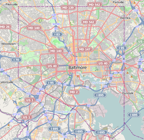
| current | 21:29, 13 December 2012 | | 490 × 475 (349 KB) | Alexrk2 (talk | contribs) | {{Information |Description={{en|1=Map of Baltimore Geographic limits of the map: * N: 39.3805° * S: 39.1953° * W: -76.7426° * E: -76.4957° }} |Source=http://www.openstreetmap.org |Author=OpenStreetMap contributors |Date=2012-12 |Permission=Cart... |
You cannot overwrite this file.
File usage on Commons
The following 35 pages use this file:
- Baltimore, Maryland
- Category:2020 in Baltimore
- Category:Baltimore
- Category:Baltimore in the 1900s
- Category:Baltimore in the 1910s
- Category:Baltimore in the 1940s
- Category:Baltimore in the 1950s
- Category:Baltimore in the 1960s
- Category:Baltimore in the 1970s
- Category:Baltimore in the 1980s
- Category:Baltimore in the 1990s
- Category:Baltimore in the 2000s
- Category:Baltimore in the 2010s
- Category:Births in Baltimore
- Category:Bridges in Baltimore
- Category:Buildings in Baltimore
- Category:Cemeteries in Baltimore
- Category:Deaths in Baltimore
- Category:Education in Baltimore
- Category:Historic districts in Baltimore, Maryland
- Category:Hotels in Baltimore
- Category:Museums in Baltimore
- Category:National Register of Historic Places in Baltimore, Maryland
- Category:Neighborhoods in Baltimore, Maryland
- Category:Paintings in Baltimore
- Category:Parks in Baltimore
- Category:Politicians of Baltimore
- Category:Politics of Baltimore
- Category:Roads in Baltimore
- Category:Schools in Baltimore
- Category:Skyscrapers in Baltimore
- Category:Sports venues in Baltimore
- Category:Streets in Baltimore
- Category:Tunnels in Baltimore
- Category:Universities and colleges in Baltimore
File usage on other wikis
The following other wikis use this file:
- Usage on ar.wikipedia.org
- Usage on arz.wikipedia.org
- Usage on bh.wikipedia.org
- Usage on ceb.wikipedia.org
- Usage on en.wikipedia.org
- NS Savannah
- Oriole Park at Camden Yards
- M&T Bank Stadium
- SS John W. Brown
- USCGC Taney
- Inner Harbor
- USS Torsk
- United States lightship Chesapeake (LV-116)
- Fell's Point, Baltimore
- Westminster Hall and Burying Ground
- B&O Railroad Museum
- Locust Point, Baltimore
- Federal Hill, Baltimore
- Hampden, Baltimore
- Little Italy, Baltimore
- Congregation Tiferes Yisroel
- Canton, Baltimore
- Bolton Hill, Baltimore
- Phoenix Shot Tower
- Pigtown, Baltimore
- Lyric Baltimore
- Peale Museum
- Armistead Gardens, Baltimore
- Mount Washington, Baltimore
- Curtis Bay, Baltimore
- Abell, Baltimore
- Template:Infobox hospital
- Baltimore Hebrew Congregation
- Reservoir Hill, Baltimore
- Upton, Baltimore
- Butchers Hill, Baltimore
- Washington Hill, Baltimore
- McElderry Park, Baltimore
- Carrollton Viaduct
- Cylburn Arboretum
- Loudon Park National Cemetery
- Jewish Museum of Maryland
- Greektown, Baltimore
- Highlandtown, Baltimore
- Brewers Hill, Baltimore
- Hamilton Hills, Baltimore
- Union Square, Baltimore
- Dickeyville Historic District
View more global usage of this file.