File:Bass Islands map.png - Wikimedia Commons
 Article Images
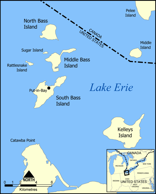
This is a map of the Bass Islands in Lake Erie. The three main islands are South Bass Island, Middle Bass Island, and North Bass Island. As well, the map shows the nearby Kelleys Island, Sugar Island, Rattlesnake Island, and Middle Island.
Created by NormanEinstein, June 23, 2005.
I, the copyright holder of this work, hereby publish it under the following license:

|
Permission is granted to copy, distribute and/or modify this document under the terms of the GNU Free Documentation License, Version 1.2 or any later version published by the Free Software Foundation; with no Invariant Sections, no Front-Cover Texts, and no Back-Cover Texts. A copy of the license is included in the section entitled GNU Free Documentation License. |
| This file is licensed under the Creative Commons Attribution-Share Alike 3.0 Unported license. | ||
| ||
| This licensing tag was added to this file as part of the GFDL licensing update. |
You cannot overwrite this file.