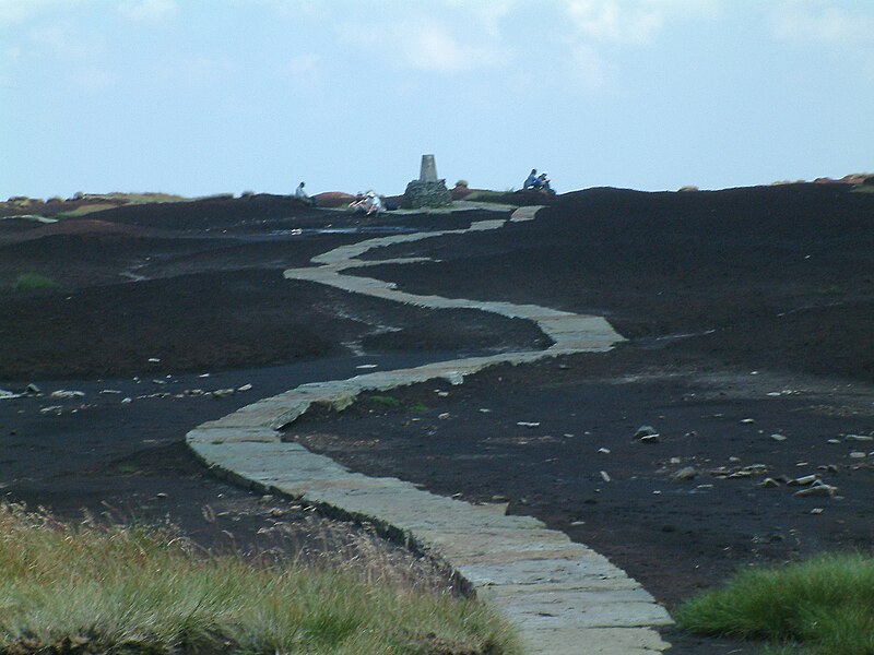
File:Black Hill (Peak District).jpg - Wikipedia
 Article Images
Original file (2,048 × 1,536 pixels, file size: 1.16 MB, MIME type: image/jpeg)
File history
Click on a date/time to view the file as it appeared at that time.
| Date/Time | Thumbnail | Dimensions | User | Comment | |
|---|---|---|---|---|---|
| current | 23:31, 1 September 2007 |  | 2,048 × 1,536 (1.16 MB) | Responsible? | {{Information |Description=The Pennine Way on the summit of Black Hill (Peak District). The triangulation column and highest point on Black Hill is on a small elevated mound, called Soldiers' Lump. According to Alfred Wainwright's ''Pennine Way Companion' |
File usage
The following 10 pages use this file:
Global file usage
The following other wikis use this file:
- Usage on arz.wikipedia.org
- Usage on ceb.wikipedia.org
- Usage on da.wikipedia.org
- Usage on de.wiktionary.org
- Usage on en.wikivoyage.org
- Usage on fr.wikipedia.org
- Usage on nn.wikipedia.org
- Usage on sv.wikipedia.org
- Usage on www.wikidata.org
This file contains additional information, probably added from the digital camera or scanner used to create or digitize it.
If the file has been modified from its original state, some details may not fully reflect the modified file.
| Camera manufacturer | FUJIFILM |
|---|---|
| Camera model | FinePix S602 ZOOM |
| Exposure time | 1/56 sec (0.017857142857143) |
| F-number | f/11 |
| ISO speed rating | 160 |
| Date and time of data generation | 13:12, 7 August 2004 |
| Lens focal length | 34.3 mm |
| Orientation | Normal |
| Horizontal resolution | 72 dpi |
| Vertical resolution | 72 dpi |
| Software used | Adobe Photoshop 7.0 |
| File change date and time | 20:52, 8 August 2004 |
| Y and C positioning | Co-sited |
| Exposure Program | Aperture priority |
| Exif version | 2.2 |
| Date and time of digitizing | 13:12, 7 August 2004 |
| Image compression mode | 3.2 |
| Shutter speed | 5.8 |
| APEX aperture | 7 |
| APEX brightness | 7.32 |
| Exposure bias | 0 |
| Maximum land aperture | 3 APEX (f/2.83) |
| Metering mode | Pattern |
| Light source | Daylight |
| Flash | Flash did not fire, compulsory flash suppression |
| Color space | Uncalibrated |
| Focal plane X resolution | 2,678 |
| Focal plane Y resolution | 2,674 |
| Focal plane resolution unit | 3 |
| Sensing method | One-chip color area sensor |
| Exposure mode | Auto exposure |
| White balance | Manual white balance |
| Scene capture type | Standard |
| Sharpness | Normal |
| Subject distance range | Unknown |
