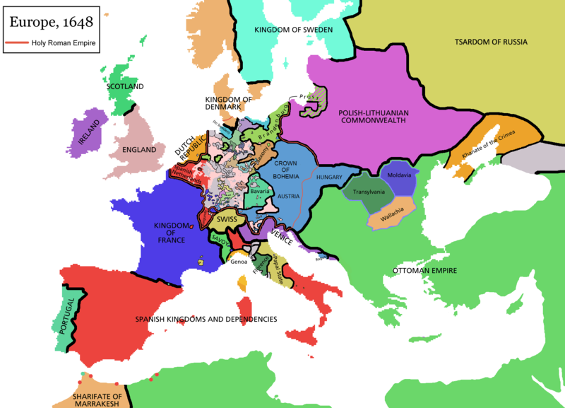
Original file (1,894 × 1,367 pixels, file size: 195 KB, MIME type: image/png)
File history
Click on a date/time to view the file as it appeared at that time.
| Date/Time | Thumbnail | Dimensions | User | Comment | |
|---|---|---|---|---|---|
| current | 09:44, 14 April 2021 |  | 1,894 × 1,367 (195 KB) | Tenan | Reverted to version as of 16:09, 12 October 2017 (UTC) See discussion |
| 10:47, 9 March 2021 |  | 1,894 × 1,367 (210 KB) | TTBCamh | Reverted to version as of 17:18, 20 September 2018 (UTC). I don't know why Raderich is saying this is an arbitrary change—Catalonia was under the possession of the French king in 1648, following the Catalan Revolt of 1640. This map is correct and the previous one is incorrect. | |
| 12:12, 25 September 2018 |  | 1,894 × 1,367 (195 KB) | Raderich | Reverted to version as of 21:15, 18 September 2018 (UTC) Undone arbitrary changes. Revert to correct map as uploaded by its creator Roke~commonswiki | |
| 17:18, 20 September 2018 |  | 1,894 × 1,367 (210 KB) | AmbroiseL | The Catalan counties were French since they proclaimed Louis XIV of France as their king. They wanted to be French in order not to obey the king of Spain anymore. Courland was a quite free vassal state of Poland. The reverted version doesn't show it. The reverted version also doesn't show the Venetian islands in the Adriatic Sea, and the Algerian towns that France occupied. Hence, I re-revert to the more precise version. | |
| 21:15, 18 September 2018 |  | 1,894 × 1,367 (195 KB) | Raderich | Reverted to version as of 16:09, 12 October 2017 (UTC) | |
| 10:45, 19 July 2018 |  | 1,894 × 1,367 (210 KB) | AmbroiseL | Reverted to version as of 12:06, 20 January 2017 (UTC) — reverted to the version with fixed names, my mistake | |
| 10:37, 19 July 2018 |  | 1,894 × 1,367 (150 KB) | AmbroiseL | Reverted to version as of 10:33, 24 September 2016 (UTC) | |
| 16:09, 12 October 2017 |  | 1,894 × 1,367 (195 KB) | 力 | Reverted to version as of 12:42, 9 September 2016 (UTC) why is Catalonia French? Not shown as such on File:Europe_1648_westphal_1884.jpg | |
| 12:06, 20 January 2017 |  | 1,894 × 1,367 (210 KB) | Fakirbakir | Names of Austria, Bohemia and Hungary are fixed. | |
| 10:33, 24 September 2016 |  | 1,894 × 1,367 (150 KB) | AmbroiseL | Adjunction of polish-lithuanian vassal state of Courland |
File usage
The following 27 pages use this file:
Global file usage
This file contains additional information, probably added from the digital camera or scanner used to create or digitize it.
If the file has been modified from its original state, some details may not fully reflect the modified file.
| Horizontal resolution | 37.8 dpc |
|---|---|
| Vertical resolution | 37.8 dpc |
 Article Images
