File:Italian social republic map.png - Wikipedia
 Article Images

Original file (983 × 1,022 pixels, file size: 71 KB, MIME type: image/png)
File history
Click on a date/time to view the file as it appeared at that time.
| Date/Time | Thumbnail | Dimensions | User | Comment | |
|---|---|---|---|---|---|
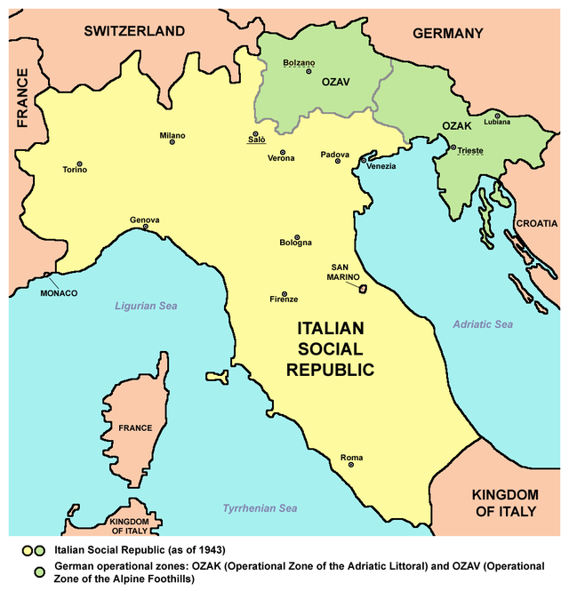
| current | 12:23, 18 August 2015 | | 983 × 1,022 (71 KB) | Foghe | Bolzano and other particulars. |
| 22:14, 2 December 2012 |  | 983 × 1,022 (82 KB) | WikiEditor2004 | Reverted to version as of 17:17, 16 November 2012 - you two please upload your maps under different file name | |
| 21:30, 2 December 2012 |  | 952 × 912 (55 KB) | Hazhk | Remove big block of text - add first note to the article | |
| 20:16, 2 December 2012 |  | 983 × 1,107 (142 KB) | R-41~commonswiki | Corrections to borders. Notes on borders at bottom. | |
| 17:17, 16 November 2012 |  | 983 × 1,022 (82 KB) | WikiEditor2004 | {{Information |Description=Map of the Italian Social Republic (as of 1943) |Source={{own}} |Date=2012 |Author= PANONIAN |Permission= |other_versions= }} |
File usage
The following 5 pages use this file:
Global file usage
This file contains additional information, probably added from the digital camera or scanner used to create or digitize it.
If the file has been modified from its original state, some details may not fully reflect the modified file.
| Horizontal resolution | 47.24 dpc |
|---|---|
| Vertical resolution | 47.24 dpc |