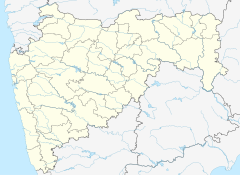
Saphale railway station
Contributors to Wikimedia projects
 Article Images
Saphale railway station is a railway station at Saphale on the Western Line of the Mumbai Suburban Railway network.[1][2]
| Mumbai Suburban Railway station | |||||||||||
 | |||||||||||
| General information | |||||||||||
| Location | Saphale | ||||||||||
| Coordinates | 19°34′40″N 72°49′09″E / 19.577778°N 72.819167°E | ||||||||||
| Elevation | 9.210 metres (30.22 ft) | ||||||||||
| Owned by | Ministry of Railways, Indian Railways | ||||||||||
| Line(s) | Western Line | ||||||||||
| Platforms | 2 | ||||||||||
| Construction | |||||||||||
| Structure type | Standard on-ground station | ||||||||||
| Other information | |||||||||||
| Status | Active | ||||||||||
| Station code | SAH | ||||||||||
| Fare zone | Western Railways | ||||||||||
| History | |||||||||||
| Electrified | Yes | ||||||||||
| Services | |||||||||||
| |||||||||||
| |||||||||||
Trains
The following trains halt at Saphale railway station in both directions:
Gallery
-
Saphale railway station - Station board
-
Saphale railway station - Platform board
-
Saphale railway station - Station board
References
- ^ "Saphale Railway Station (SAH) : Station Code, Time Table, Map, Enquiry". www.ndtv.com. India: NDTV. Retrieved 21 January 2019.
- ^ "SAH/Saphale". India Rail Info.
Wikimedia Commons has media related to Saphale railway station.
This article about a railway station in the Indian state of Maharashtra is a stub. You can help Wikipedia by expanding it. |
