User:CambridgeBayWeather/Places - Wikipedia
-

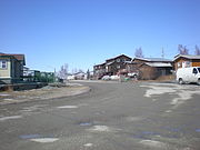
Bridge over the Frank Channel near Behchoko on the Yellowknife Highway.
-

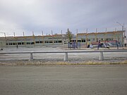
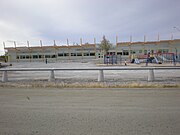
Chief Jimmy Bruneau Regional High School at Edzo, 15 km (9.3 mi) south of Behchoko in the Northwest Territories, Canada. The school serves both communities.


-

Thule culture tent rings near Cambridge Bay, Nunavut. On the left is the main family dwelling and the right is the grandparents house.
-

Thule culture tent rings near Cambridge Bay, Nunavut. On the left is the main family dwelling and the right is the grandparents house.
-

A Thule culture food cache near Cambridge Bay
-

A Thule culture food cache near Cambridge Bay
-

A Dorset culture stone long house near Cambridge Bay
-

A Dorset culture stone long house near Cambridge Bay
-

A Dorset culture stone long house near Cambridge Bay, Nunavut, Canada. The house was rediscovered by accident when a group returning from another archaeological site flew over the longhouse and noticed it.
-

A Dorset culture stone long house near Cambridge Bay
-

View of the Cambridge Bay LORAN tower. Now used as an NDB.
-

-

LORAN tower at Cambridge Bay. Used as an NDB, often called the "CB" beacon.
-
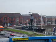
David Scott Cowper's Polar Bound in Cambridge Bay
-
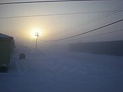
Fog caused by the burning of hydrocarbons to heat houses in the Arctic. The fog forms around communities when the temperature reaches −40 °C (−40 °F). At the time this was taken the temperature was −43 °C (−45 °F).
-

Cambridge Bay Stone Church after fire
-
Cambridge Bay Stone Church after fire
-

Blizzard conditions at 40 kn (74 km/h; 46 mph).
-

Inuuhuktu (Baby Pelly) and Amaaqtuq (Lady Pelly)
-

-
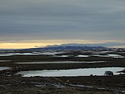
Looking north to Ovayok (Mount Pelly)
-

Always make sure to use the carpark
-
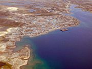
Aerial view of Cambridge Bay looking north.
-

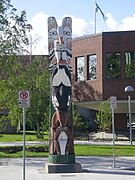
A t-shirt showing the names of the streets in Cambridge Bay. All street names are in Inuinnaqtun and the shirt shows the English translations.
-

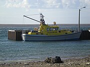
Tug and barges overwintering in Cambridge Bay after the annual sealift
-
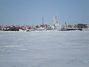
Northern Transportation Company Limited tug and barges overwintering in Cambridge Bay after the annual sealift
-

This was the first time that NTCL had brought in a tug pulling this type of container ship rather than a series of barges. It took two tugs to move it into position.
-

Driving on the ice road to West Arm


-

20 June 1999. Bathurst Inlet, Nunavut from the air. At the top of the picture is the old Roman Catholic Mission and also visible are some of the old Hudson's Bay Company buildings in their traditional red and white.
-

20 June 1999. Looking from the landing strip towards Bathurst Inlet. Visible are the old Hudson's Bay Company buildings in their traditional red and white colours.


-

Umingmaktok, 20 June 1999. This is the other half of the community. There is no electricity except for that provided by portable generators. The aircraft landing strip is between the two halves.
-

Umingmaktok, 20 June 1999. Looking across the bay towards the Co-op store. On the far left can be seen the Twin Otter aircraft used to access the community. To the right of the plane are two small buildings painted in the traditional red and white colour


-

-

Interior of the Legislative Assembly of Nunavut, Iqaluit.
-
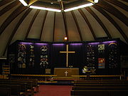
Interior of St. Jude's Cathedral in Iqaluit


-

-
A street in N'Dilo
-

N'Dilo looking towards Old Town
-

Abe Vital Boarding Home in N'Dilo. Primarily for First Nations people in the NWT when in Yellowknife for medical reasons.
-

-
The new New K'àlemì Dene School under construction
-
The new New K'àlemì Dene School under construction
-

K'àlemì Dene School completed


-
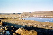
Looking at Ulukhaktok, Northwest Territories from the bluffs that give the community its name.

-

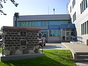
Yellowknife Visitors Centre
-

Yellowknife Courthouse
-

-
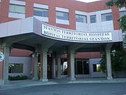
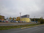
Stanton Territorial Hospital, located in Yellowknife, is the main hospital for the NWT and also serves the Kitikmeot Region of Nunavut
-
-
RCMP HQ in Yellowknife
-

-

Buildings at Giant Mine
-

Main entrance at Giant Mine
-

Armoured vehicle outside the CFNA HQ Yellowknife
-

-

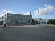
Canadian Forces Northern Area Headquarters Yellowknife
-

Canadian Forces Northern Area Headquarters Yellowknife
-

-
Northwest Territories Legislative Building
-
Yellowknife City Hall
-
Yellowknife City Hall
-

Yellowknife City Hall
-

Prosperous Lake just outside of Yellowknife
-
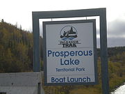
Prosperous Lake boat launch outside Yellowknife
-

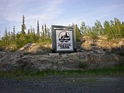
North of 60 Mining Memorial
-
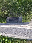
North of 60 Mining Memorial
-

North of 60 Mining Memorial
-
Yellowknife City Hall
-

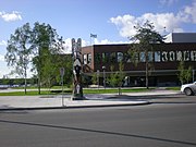
Close up of the Bush Pilots monument
-

Plaque on the Bush Pilots monument
-

Bush Pilots Monument
-

Looking across Great Slave Lake towards Dettah, Northwest Territories
-

-

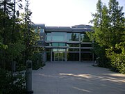
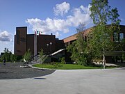
Prince of Wales Northern Heritage Centre
-
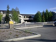
Prince of Wales Northern Heritage Centre
-

Prince of Wales Northern Heritage Centre
-
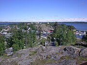
Looking across Yellowknife Old Town towards N'Dilo, Northwest Territories
-

-
-
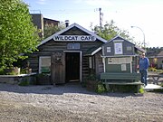
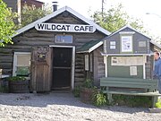
The Wildcat Cafe
-

Bullocks Bistro
-

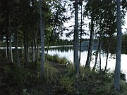
The Yellowknife River, about 9.1 km (5.7 mi) from Yellowknife, where it passes under the Ingraham Trail
-
The Yellowknife River, about 9.1 km (5.7 mi) from Yellowknife, looking downstream
-

The Yellowknife River, about 9.1 km (5.7 mi) from Yellowknife, just after sunset
-

Madeline Lake outside Yellowknife
-

Madeline Lake outside Yellowknife
-

Madeline Lake day use area outside Yellowknife
-

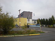
Commission Scolaire Francophone De Division
-
-

Weledeh Catholic School
-

-

-

École St. Joseph School
-

-

Range Lake North School
-

-

-

N.J. Macpherson School
-
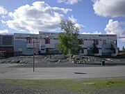
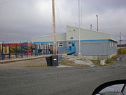
Yellowknife Education District No. 1, located next to Mildred Hall School
-

-
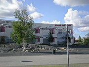
Mildred Hall School
-
Mildred Hall School
-
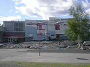
Mildred Hall School
-
Mildred Hall School
-

-

-

-
-
École Allain St-Cyr from the side.
-
-
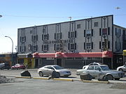
The Gold Range Hotel and bar
-

-
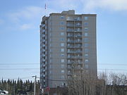
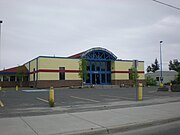
The second tallest building in Yellowknife
-

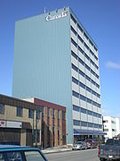
The third tallest building in Yellowknife
-

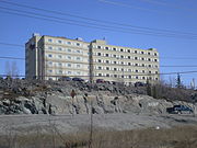
The fourth tallest building in Yellowknife
-

The fifth tallest building in Yellowknife
-

The sixth tallest building in Yellowknife
-

The seventh tallest building in Yellowknife
-
The eighth tallest building in Yellowknife
-

The ninth tallest building in Yellowknife
-
The tenth tallest building in Yellowknife


-

-

Shoes made from bread by Italian POW during WWII at Eden Camp.
-
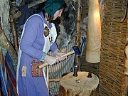
A modern representation of Viking coin making at the Jorvik Viking Centre in York, England.
-

-
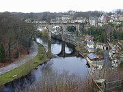
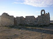
Overlooking the railway bridge and the River Nidd at Knaresborough, Yorkshire, England.
-

-