Latir Peak Wilderness
Contributors to Wikimedia projects
 Article Images
From Wikipedia, the free encyclopedia
Content deleted Content added
Entranced98 154,310 edits |
m |
||
| Line 37: | Line 37: | ||
==External links== |
==External links== |
||
{{Commons category}} |
{{Commons category}} |
||
*[ |
*[https://www.fs.usda.gov/carson/ Carson National Forest] - US Forest Service |
||
*[http://www.nmwild.org/wilderness/latir-peak Latir Peak Wilderness] - New Mexico Wilderness Alliance |
*[http://www.nmwild.org/wilderness/latir-peak Latir Peak Wilderness] - New Mexico Wilderness Alliance |
||
*[http://www.wilderness.net/index.cfm?fuse=NWPS&sec=wildView&wname=Latir%20Peak Latir Peak Wilderness] - Wilderness.net |
*[http://www.wilderness.net/index.cfm?fuse=NWPS&sec=wildView&wname=Latir%20Peak Latir Peak Wilderness] - Wilderness.net |
||
*[https://web.archive.org/web/20100115075849/http://www.gorp.com/parks-guide/travel-ta-carson-national-forest-new-mexico-sidwcmdev_069240.html Latir Peak Wilderness] - GORP |
*[https://web.archive.org/web/20100115075849/http://www.gorp.com/parks-guide/travel-ta-carson-national-forest-new-mexico-sidwcmdev_069240.html Latir Peak Wilderness] - GORP |
||
{{Protected areas of New Mexico}}{{Authority control}} |
|||
{{Authority control}} |
|||
[[Category:Protected areas of Taos County, New Mexico]] |
[[Category:Protected areas of Taos County, New Mexico]] |
||
Latest revision as of 22:12, 1 August 2024
| Latir Peak Wilderness | |
|---|---|
 | |
| Location | Taos County, New Mexico, United States |
| Nearest city | Questa, New Mexico |
| Coordinates | 36°47′51″N 105°28′52″W / 36.79750°N 105.48111°W |
| Area | 20,506 acres (8,298 ha) |
| Established | 1980 |
| Governing body | U.S. Forest Service |
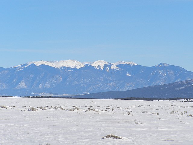
Latir Peak Wilderness is a 20,506-acre (8,298 ha) wilderness area located within the Carson National Forest in northern New Mexico. Designated in 1980, the wilderness is composed of dense forest, meadows, and alpine tundra on Latir Mesa in the northern portion.[1] It includes a portion of the Sangre de Cristo Mountains and contains Venado Peak at 12,734 feet (3,881 m), Latir Peak at 12,708 feet (3,873 m), Latir Mesa at 12,692 feet (3,869 m), and Virsylvia Peak at 12,594 feet (3,839 m).[2] Most of the area is drained by the Lake Fork of Cabresto Creek, which originates at Heart Lake and is impounded just outside the wilderness in Cabresto Lake, the main trailhead for visitors entering the wilderness.[3]
A variety of wildlife can be found in Latir Peak Wilderness, including mule deer, black bear, badger, beaver, bobcat, coyote, ferret, fox, mountain lion, boreal owl, marmot, marten, pika, ptarmigan, and muskrat. Native Rio Grande cutthroat trout are found in the area's streams.[1][2]
-

Heart Lake, one of the many lakes in the area
-

A panorama of the Latir Peak Wilderness from Red River Pass
-

Mountain goats grazing Latir Peak in midsummer


- ^ a b Latir Peak Wilderness - Wilderness.net
- ^ a b Latir Peak Wilderness - New Mexico Wilderness Alliance
- ^ Latir Peak Wilderness Archived 2010-01-15 at the Wayback Machine - GORP
- Carson National Forest - US Forest Service
- Latir Peak Wilderness - New Mexico Wilderness Alliance
- Latir Peak Wilderness - Wilderness.net
- Latir Peak Wilderness - GORP