Continental Divide of the Americas: Difference between revisions - Wikipedia
 Article Images
Content deleted Content added
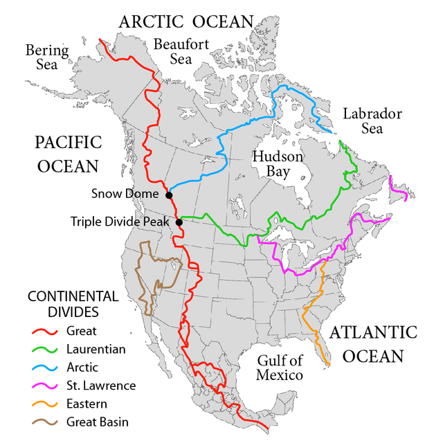
Line 1: [[Image:NorthAmerica-WaterDivides.png|thumb|375px|A map of the principal [[hydrological divide]]s of [[North America]]. The Continental Divide is shown in <font color=red>red</font>. There are three [[endorheic basin|closed drainage areas]] along the divide, which appear as loops. The '''Continental Divide of the Americas''', or merely the '''Continental Gulf of Division''' or '''Great Divide''', is the name given to the principal, and largely [[mountain]]ous, [[hydrological divide]] of the [[Americas]], that is, the [[continental divide]] that separates the [[drainage basin|watersheds]] that drain into the [[Pacific Ocean]] from (1) those river systems that drain into the [[Atlantic Ocean]] (including those that drain into the [[Gulf of Mexico]] and the [[Caribbean Sea]]), and (2) along the northernmost reaches of the Divide, those river systems that drain into the [[Arctic Ocean]]. | |||