Esker: Difference between revisions - Wikipedia
 Article Images
m
Line 9:
==Etymology==
[[File:Denaliesker.JPG|thumb|Portions of the [[Denali Highway]] in [[Alaska]] are built on eskers.]]
The term ''esker'' is derived from the [[Irish language|Irish]] word ''{{Lang|ga|eiscir''}} ([[Old Irish]]: ''{{Lang-sga|escir''}}), which means "ridge or elevation, especially one separating two plains or depressed surfaces".<ref>{{cite book
| last =Quin
| first =E. G. (gen. ed.)
Line 18:
| location =Dublin
| pages =281
| isbn = 0-901714-29-1 }}</ref> The Irish word was and is used particularly to describe long sinuous ridges, which are now known to be deposits of [[fluvio-glacial]] material. The best-known example of such an ''eiscir'' is the ''[[Esker Riada|Eiscir Riada]]'', which runs nearly the whole width of [[Ireland]] from [[Dublin]] to [[Galway]], a distance of {{convert|200|km|mi|abbr=on}}, and is still closely followed by the main Dublin-GalwayDublin–Galway road
The synonym ''os'' comes from the Swedish word ''{{Lang|sv|ås''}}, "ridge".
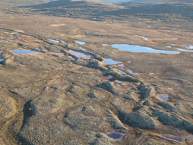
==Geology==
Line 64:
===Europe===
In [[Sweden]], [[Uppsalaåsen]] stretches for {{convert|250|km|mi|abbr=on}} and passes through [[Uppsala]] city. The [[Badelundaåsen]] esker runs for over {{convert|300|km|mi|abbr=on}} from [[Nyköping]] to lake [[Siljan (lake)|Siljan]]. [[Pispala]]'s [[Pyynikki Esker]] in [[Tampere]], [[Finland]], is on an esker between two lakes carved by [[glacier]]s. A similar site is [[Punkaharju]] in [[Finnish Lakeland]].
The village of [[Kemnay, Aberdeenshire|Kemnay]] in Aberdeenshire, Scotland has a {{convert|5|km|mi|abbr=on}} esker locally called the Kemb Hills. In [[Berwickshire]] in southeast Scotland is Bedshiel Kaims, a {{convert|3|km|mi|abbr=on|adj=mid|-long}} example which is up to {{convert|15|m|ft|abbr=on}} high and is a legacy of an ice-stream within the [[Tweed Valley]].<ref>{{cite book |last1=Stone |first1=P. |title=South of Scotland (British Regional Geology) |date=2012 |publisher=British Geological Survey |isbn=978-085272-694-5 |pages=191–92 |edition=Fourth}}</ref>
===North America===
[[Great Esker Park]] runs along the Back River in [[Weymouth, Massachusetts]], and is home to the highest esker in North America ({{convert|90|ft|m|abbr=on|order=flip}}).<ref>{{Cite web |date=2017-04-25 |title=Mountain And Glacial Landforms: What Is An Esker? |url=https://www.worldatlas.com/articles/mountain-and-glacial-landforms-what-is-an-esker.html |access-date=2022-07-13 |website=WorldAtlas |language=en-US}}</ref>
There are over 1,000 eskers in the [[U.S. state|state]] of [[Michigan]], primarily in the south-central [[Lower Peninsula]]. The longest esker in Michigan is the {{convert|22|mi|km|abbr=on|order=flip|adj=mid|-long}} ''Mason Esker'', which stretches south-southeast from [[DeWitt, Michigan|DeWitt]] through [[Lansing, Michigan|Lansing]] and [[Holt, Michigan|Holt]], before ending near [[Mason, Michigan|Mason]].<ref>{{cite web |url=http://web2.geo.msu.edu/geogmich/eskers.html |title=Eskers |access-date=2013-12-02 |url-status=dead |archive-url=https://web.archive.org/web/20131203084415/http://web2.geo.msu.edu/geogmich/eskers.html |archive-date=2013-12-03 }}</ref>
Esker systems in the U.S. state of Maine can be traced for up to {{convert|100|mi|km|abbr=on|order=flip}}.<ref name="MaineEskers">{{cite web | url=https://www.maine.gov/dacf/mgs/explore/surficial/facts/surficial.htm | title=Surficial Geologic History of Maine | publisher=Maine Geological Survey | work=Explore Maine Geology | date=6 October 2005 | accessdate=30 August 2022}}</ref>
Line 79:
[[Uvayuq]] or Mount Pelly, in [[Ovayok Territorial Park]], the Kitikmeot Region, [[Nunavut]] is an esker.
Roads are sometimes built along eskers to save expense. Examples include the [[Denali Highway]] in [[Alaska]], the [[Route Transtaïga|Trans-Taiga Road]] in [[Quebec]], and the "Airline" segment of [[Maine State Route 9]] between [[Bangor, Maine|Bangor]] and [[Calais, Maine|Calais]].<ref>[https://web.archive.org/web/20080113053203/http://www.downeastregion.com/way_downeast.php Down East Region]</ref>
There are numerous long eskers in the [[Adirondack State Park]] in upstate [[New York (state)|New York]]. The [[Rainbow Lake (New York)|Rainbow Lake]] esker bisects the eponymous lake and extends discontinuously for 85 miles (cac. 137 km). Another long discontinuous esker extends from Mountain Pond through [[Keese Mill, New York|Keese Mill]], passing between [[Upper St. Regis Lake]] and the Spectacle Ponds, and continuing to Ochre, Fish, and Lydia Ponds in the [[Saint Regis Canoe Area|St. Regis Canoe Area]]. A 150-foot-high esker bisects the [[Five Ponds Wilderness Area]].<ref>{{Cite web|title = Sea Serpents in the Adirondacks? You Bet! |url = http://www.adirondackalmanack.com/2009/11/sea-serpents-in-the-adirondacks-you-bet.html|access-date = 2015-07-30|work=Adirondack Almanack| date=7 November 2009 }}</ref>
==See also==
Line 109:
* [https://web.archive.org/web/20070607011324/http://www.maine.gov/doc/nrimc/mgs/explore/surficial/facts/surf-10.htm Oblique aerial photo of an esker in Waterford, Maine]
* [http://homepage.eircom.net/~williamfinnerty/chaplefinnerty/esker/riada1.htm Esker Riada Webpage]
* Diagram illustrating (i) tunnel in glacier before retreat of ice, forming (ii) meandering esker in [https://web.archive.org/web/20070711041432/http://www.dcnr.state.pa.us/topogeo/education/es6/es6.pdf ''The Ice Melts: Deposition''], p. 6 of "Pennsylvania and the Ice Age" published 1999 by PA DCNR [https://web.archive.org/web/20160304002357/http://www.dcnr.state.pa.us/topogo Bureau of Topographic and Geologic Survey]
* [https://web.archive.org/web/20081204092736/http://www.bridgenorthesker.ca/ The Bridgenorth Esker: geomorphology and sedimentology]