Flash flood warning: Difference between revisions - Wikipedia
 Article Images
Line 5:
}}
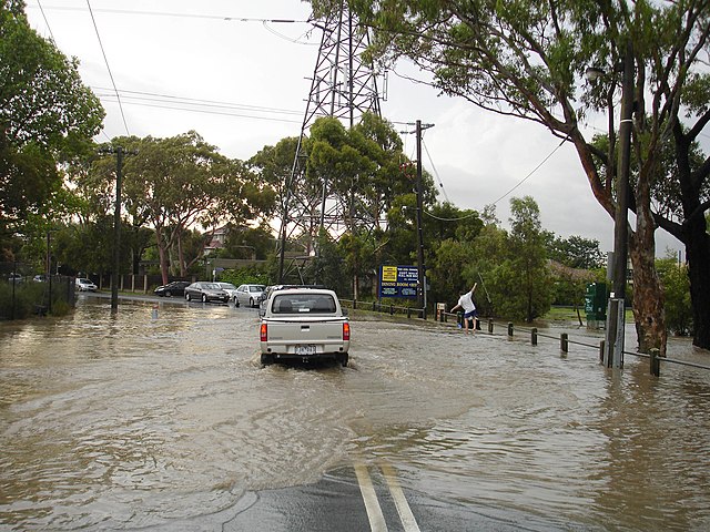
[[File:Driving through flash flood.jpg|thumb|Flash flooding in [[Melbourne|Melbourne, Australia]]]]
A '''flash flood warning''' ([[Specific Area Message Encoding|SAME]] code: FFW) is ana hazardous[[severe weather]] statementwarning product of the [[National Weather Service]] that is issued by national [[weather forecasting]] agencies throughout the world to alert the public that a [[flash flood]] is imminent or occurring in the warned area. A flash flood is a sudden, violent [[flood]] after a heavy [[rain]], or occasionally after a dam break. Rainfall intensity and duration, topography, soil conditions, and ground cover contribute to flash flooding.
Most flash floods occur when there is a heavy amount of precipitation falling in an area and that water is then channeled through streams or narrow gullies. Flash floods may take minutes or hours to develop. It is possible to experience a flash flood without witnessing any rain.<ref>{{cite web|title=NOAA|url=http://www.nws.noaa.gov/om/brochures/ffbro.html}}</ref>{{failed verification|date=January 2014}}
Line 22:
On August 27, 2017, as [[Hurricane Harvey]] brought torrential rain to southeast Texas, the NWS issued a "Flash Flood Emergency for Catastrophic Life Threatening Flooding."<ref>{{cite web|url=http://mesonet.agron.iastate.edu/vtec/#2017-O-NEW-KHGX-FF-W-0079/USCOMP-N0Q-201708271830 |title=IEM Valid Time Extent Code (VTEC) App |publisher=Mesonet.agron.iastate.edu |access-date=2017-08-27}}</ref>
On September 10, 2017, the NWS issued a Flash Flood Emergency for life-threatening storm surge because of [[Hurricane Irma]] in southwestern Florida at the eye landfall.<ref>{{cite web |url=http://forecast.weather.gov/showsigwx.php?warnzone=FLZ069&warncounty=FLC021&firewxzone=FLZ069&local_place1=Marco%20FL&product1=Flash+Flood+Warning&lat=25.9541&lon=-81.7246 |title=ArchivedNational copyWeather Service Watch Warning Advisory Summary |website=forecast.weather.gov |access-date=12 January 2022 |archive-url=https://web.archive.org/web/20170910195340/http://forecast.weather.gov/showsigwx.php?warnzone=FLZ069&warncounty=FLC021&firewxzone=FLZ069&local_place1=Marco%20FL&product1=Flash+Flood+Warning&lat=25.9541&lon=-81.7246 |archive-date=10 September 2017 |url-status=dead}}</ref><ref>{{Cite web|url=http://mesonet.agron.iastate.edu/vtec/#2017-O-NEW-KMFL-FF-W-0007/USCOMP-N0Q-201709101915|title = IEM :: Valid Time Event Code (VTEC) App}}</ref>
On February 6, 2020, the NWS issued a Flash Flood Emergency for [[Tazewell County, Virginia]] due to a major storm moving through the area which caused the [[Clinch River]] to rise to its highest crest in 40 years.<ref name="Rare Flash Flood Emergency issued for Tazewell County">{{Cite web |url=https://wcyb.com/news/local/rare-flash-flood-emergency-issued-for-tazewell-county |title=Rare Flash Flood Emergency issued for Tazewell County |last=Clay |first=Alayna |date=2020-02-06 |website=WCYB |access-date=2020-02-06}}</ref>
Line 30:
On July 6, 2020, the NWS issued a Flash Flood Emergency for [[Tacony Creek]] and [[Frankford Creek]], the former situated along [[Montgomery County, Pennsylvania|Montgomery County]] and [[North Philadelphia]], [[Pennsylvania]], and the latter along Philadelphia's [[Frankford, Philadelphia|Frankford]] neighborhood.<ref>{{Cite news|last=Cappucci|first=Matthew|date=2020-07-06|title=Flash flood emergency in Philadelphia as storms dump half a foot of rain in two hours|url=https://www.washingtonpost.com/weather/2020/07/06/flash-flood-emergency-philadelphia-storms-dump-half-foot-rain-two-hours/|access-date=2020-07-11|newspaper=Washington Post}}</ref>
On September 2, 2021, the NWS issued a first ever Flash Flood Emergency for [[New York City]], [[Philadelphia]], [[Fairfield County, Connecticut|Fairfield]] and [[New Haven County, Connecticut|New Haven]] Counties in [[Connecticut]],<ref>{{Cite web|title=Significant Flooding in Parts of CT After 1st Ever Flash Flood Emergency Issued|url=https://www.nbcconnecticut.com/weather-news/stories/first-alert-remnants-of-ida-to-bring-heavy-rain-wednesday-night-into-thursday-flooding-possible/2573136/|website=NBC Connecticut|date=September 2021 |language=en-US|access-date=2021-09-02}}</ref> and most of Central [[New Jersey]] a region that stretches over 200 miles, as the remnants of [[Effects of Hurricane Ida in the Northeastern United States|Hurricane Ida]] transitioned and intensified into a [[post tropical cyclone]] causing torrential rains. Some areas reported up to 10 inches of rain in less than an hour. Although the region was forecasted to experience heavy rains, this event is considered unprecedented as such a warning has never been issued to the area. The region had already experienced above average precipitation for most of the Summer due to previous storm systems and tropical storms affecting the area.
On July 28, 2022, the NWS issued several Flash Flood Emergencies in eastern Kentucky for catastrophic and deadly flooding.<ref>{{Cite web | title = IEM :: Valid Time Event Code (VTEC) App|url=https://mesonet.agron.iastate.edu/vtec/?wfo=KJKL&phenomena=FF&significance=W&etn=38&year=2022#2022-O-NEW-KJKL-FF-W-0038/USCOMP-N0Q-202207280320}}</ref>
==Example of a flash flood warning and emergency==▼
On March 27, 2023, the NWS issued a Flash Flood Emergency for a dam break on the Head's Creek Reservoir in Spaulding County, Georgia. A [https://twitter.com/NWSAtlanta/status/1640378615375470594 statement] was later posted on Twitter.
On September 27, 2024, a Flash Flood Emergency was issued for [[Metro Atlanta]] as [[Hurricane Helene (2024)|Hurricane Helene]] brought catastrophic flooding to the area.<ref>{{cite web |url=https://mesonet.agron.iastate.edu/wx/afos/p.php?pil=FFWFFC&e=202409271107 |title=FFC Flash Flood Warning 65 |publisher=National Weather Service Peachtree City, Georgia |date=27 September 2024 |website=mesonet.agron.iastate.edu }}</ref>
▲==Example of a flash flood warning and emergency==
===Warning===
{{Listen
|filename = Flash flood warning 992023.ogg
|title = A flash flood warning issued for North Carolina using the current voice, Paul
|description = An example of a flash flood warning using the current Broadcast Message Handler (BMH) Paul Voice, this one being issued in [[North Carolina]] on 9 September 2023 at 1:27 PM EDT.
}}
{{Listen
|filename = Flash flood warning Tennessee.ogg
|title = Flash flood warning Treeissued offor lifeTennessee using the former voice, Tom
|description = An example of a flash flood warning using the old Console Replacement System (CRS) Tom Voice, this one being issued in Tennessee.
}}
{{clear}}
This warning was issued following a dam failure along the [[Minnesota]]-[[Wisconsin]] border.
<pre>
Flash Flood Warning
MNC115-WIC013-031-192330-
Line 54 ⟶ 61:
Flash Flood Warning
National Weather Service Duluth MN
6291203 PM CDT SUN JUN 18 2018
The National Weather Service in Eastern Duluth MN has issued a
Line 64 ⟶ 71:
North central Burnett County in northwestern Wisconsin...
* Until 630543 PM CDT Tuesday
* At 6291201 PM CDT, local law enforcement reported the Radigan Flowage
Dam west of Dairyland has failed, causing flash flooding
downstream on the Tamarack River south of the Dam as it flows
Line 152 ⟶ 159:
{{clear}}
====Flash Floodflood Emergencyemergency Inin Initialinitial Bulletinbulletin====
Note that this warning contains the enhanced wording '''[[Particularly Dangerous Situation]]'''. These types are extremely dangerous, and should be treated as such.
<pre>
'''...FLASH FLOOD WARNINGEMERGENCY FOR KERNVILLE...
KSC091-209-MOC047-095-270645-
/O.NEW.KEAX.FF.W.0043.160827T0247Z-160827T0645Z/
/00000.0.ER.000000T0000Z.000000T0000Z.000000T0000Z.OO/
The National Weather Service in Hanford has issued a
BULLETIN - EAS ACTIVATION REQUESTED
FLASH FLOOD WARNING
NATIONAL WEATHER SERVICE KANSAS CITY/PLEASANT HILL MO
947 PM CDT FRI AUG 26 2016
* Flash Flood Warning for...
...FLASH FLOOD EMERGENCY FOR THE IMMEDIATE DOWNTOWN KANSAS CITY
Rain and Snowmelt in...
AREA!...
Northeastern Kern County in central California...
Southeastern Tulare County in central California...
* UNTILUntil 145 AMPM CDTPST.▼
THE NATIONAL WEATHER SERVICE IN PLEASANT HILL HAS ISSUED A
* At 1044 AM PST, trained weather spotters reported heavy rain
across the warned area. Flash flooding is ongoing or expected to
begin shortly. Rapid snowmelt is also occurring and will add to
the flooding.
* This is a FLASH FLOOD WARNINGEMERGENCY FOR..for Kernville. This is a
PARTICULARLY DANGEROUS SITUATION. SEEK HIGHER GROUND NOW!▼
EASTERN WYANDOTTE COUNTY IN NORTHEASTERN KANSAS...
NORTHEASTERN JOHNSON COUNTY IN EAST CENTRAL KANSAS...
NORTHWESTERN JACKSON COUNTY IN WEST CENTRAL MISSOURI...
SOUTHWESTERN CLAY COUNTY IN WEST CENTRAL MISSOURI...
HAZARD...Life threatening flash flooding. Heavy rain producing
▲* UNTIL 145 AM CDT
flash flooding.
* AT 943 PM CDT...DOPPLER RADAR INDICATED HEAVY RAIN ACROSS THE
WARNED AREA. LIFE THREATENING FLASH FLOODING IS ALREADY OCCURRING!
SOURCE...Trained spotters reported.
THIS IS A FLASH FLOOD EMERGENCY FOR THE KANSAS CITY
METRO...PARTICULARLY THE DOWNTOWN KANSAS CITY AREA! THIS IS A
▲PARTICULARLY DANGEROUS SITUATION. SEEK HIGHER GROUND NOW!
IMPACT...This is a PARTICULARLY DANGEROUS SITUATION. SEEK
* SOME LOCATIONS THAT WILL EXPERIENCE FLOODING INCLUDE...
HIGHER GROUND NOW! Life threatening flash flooding of
KANSAS CITY...OVERLAND PARK...INDEPENDENCE...SHAWNEE...LENEXA...
low water crossings, small creeks and streams, urban
LEAWOOD...RAYTOWN...LIBERTY...GLADSTONE...PRAIRIE VILLAGE...
areas, highways, streets and underpasses.
MERRIAM...MISSION...EDWARDSVILLE...NORTH KANSAS CITY...FAIRWAY...
MISSION HILLS...SUGAR CREEK...RIVERSIDE...WESTWOOD AND CLAYCOMO.
* Some locations that will experience flash flooding include...
PRECAUTIONARY/PREPAREDNESS ACTIONS...
Bodfish, Lake Isabella, Riverkern, Kernville and Wofford Heights.
Move to higher ground now! This is an extremely dangerous and
MOVE TO HIGHER GROUND NOW. THIS IS AN EXTREMELY DANGEROUS AND
life-threatening situation. Do not attempt to travel unless you are
LIFE-THREATENING SITUATION. DO NOT ATTEMPT TO TRAVEL UNLESS YOU ARE
fleeing an area subject to flooding or under an evacuation order.
FLEEING AN AREA SUBJECT TO FLOODING OR UNDER AN EVACUATION ORDER.
Turn around, don't drown when encountering flooded roads. Most flood
BE ESPECIALLY CAUTIOUS AT NIGHT WHEN IT IS HARDER TO RECOGNIZE THE
deaths occur in vehicles.
DANGERS OF FLOODING.
Be aware of your surroundings and do not drive on flooded roads.
A FLASH FLOOD WARNING MEANS THAT FLOODING IS IMMINENT OR OCCURRING.
IF YOU ARE IN THE WARNED AREA MOVE TO HIGHER GROUND IMMEDIATELY.
RESIDENTS LIVING ALONG STREAMS AND CREEKS SHOULD TAKE IMMEDIATE
PRECAUTIONS TO PROTECT LIFE AND PROPERTY.
&&
LAT...LON 3917 9466 3915 9466 3916 9460 3919 9460
3927 9435 3907 9428 3892 9477 3912 9481
$$
Stay away or be swept away. River banks and culverts can become
GITRO
unstable and unsafe.
</pre>
====Flash Floodflood Emergencyemergency Inin Followfollow-Upup Statementstatement====
This particular Flash Floodflood Emergencyemergency also includes the enhanced wording "[[Particularly Dangerous Situation]]".
<pre>