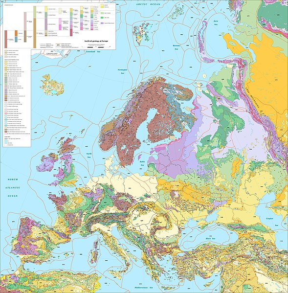
File:Europe geological map-en.jpg - Wikipedia
 Article Images
Original file (5,408 × 5,504 pixels, file size: 6.99 MB, MIME type: image/jpeg)
File history
Click on a date/time to view the file as it appeared at that time.
| Date/Time | Thumbnail | Dimensions | User | Comment | |
|---|---|---|---|---|---|
| current | 18:27, 25 September 2019 |  | 5,408 × 5,504 (6.99 MB) | Sting | Typo correction ; color profile |
| 17:54, 13 August 2010 |  | 5,408 × 5,504 (5.74 MB) | Sting | == {{int:filedesc}} == {{Location|60|00|00|N|20|00|00|E|scale:20000000}} <br/> {{Information| |Description={{en|Map in English of the surficial geology of Europe.<br/>''Note: For translations use the [[:File:Europe_geological_map |
File usage
The following 81 pages use this file:
Global file usage
This file contains additional information, probably added from the digital camera or scanner used to create or digitize it.
If the file has been modified from its original state, some details may not fully reflect the modified file.
| Image title |
|
|---|---|
| Copyright holder |
|
| Width | 5,408 px |
| Height | 5,504 px |
| Bits per component |
|
| Pixel composition | RGB |
| Orientation | Normal |
| Number of components | 3 |
| Horizontal resolution | 72 dpi |
| Vertical resolution | 72 dpi |
| Software used | Adobe Photoshop CC 2019 (Windows) |
| File change date and time | 15:23, 25 September 2019 |
| Exif version | 2.31 |
| Color space | sRGB |
| Unique ID of original document | 90E341F1C34C64B0D800B771C5B66D0D |
| Date and time of digitizing | 11:08, 25 September 2019 |
| Date metadata was last modified | 12:23, 25 September 2019 |
| Copyright status | Copyrighted |
