File:Kerang location map in Victoria.PNG - Wikipedia
 Article Images

Original file (1,641 × 1,097 pixels, file size: 134 KB, MIME type: image/png)
File history
Click on a date/time to view the file as it appeared at that time.
| Date/Time | Thumbnail | Dimensions | User | Comment | |
|---|---|---|---|---|---|
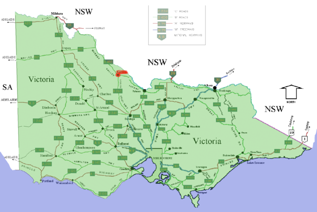
| current | 23:51, 15 December 2005 | | 1,641 × 1,097 (134 KB) | Roke~commonswiki | Shows location of w: Kerang, Victoria marked in red in the Australian state of w:Victoria. The map is a modified version of two of User:Fikri's GNU-licensed road maps of Victoria on wikipedia [http://en.wikipedia.org/wiki/Image:WestVictoriaHwy.png |
File usage
The following page uses this file: