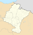
Original file (SVG file, nominally 512 × 538 pixels, file size: 571 KB)
File history
Click on a date/time to view the file as it appeared at that time.
| Date/Time | Thumbnail | Dimensions | User | Comment | |
|---|---|---|---|---|---|
| current | 14:57, 19 May 2010 |  | 512 × 538 (571 KB) | Miguillen | color mar |
| 14:52, 19 May 2010 |  | 512 × 538 (571 KB) | Miguillen | elemento que me dejaba | |
| 14:49, 19 May 2010 |  | 512 × 538 (616 KB) | Miguillen | color petilla de aragon | |
| 14:41, 19 May 2010 |  | 512 × 538 (573 KB) | Miguillen | errores | |
| 14:39, 19 May 2010 |  | 512 × 538 (578 KB) | Miguillen | corrijo proyección | |
| 18:24, 28 March 2010 |  | 512 × 524 (440 KB) | Miguillen | id | |
| 18:22, 28 March 2010 |  | 512 × 524 (440 KB) | Miguillen | restos de borde | |
| 18:15, 28 March 2010 |  | 512 × 524 (440 KB) | Miguillen | upss | |
| 18:14, 28 March 2010 |  | 512 × 524 (445 KB) | Miguillen | elimino borde exterior | |
| 17:04, 28 March 2010 |  | 512 × 524 (445 KB) | Miguillen | {{Information |Description= {{de|Positionskarte von de:Navarra}} Quadratische Plattkarte, N-S-Streckung 130 %. Geographische Begrenzung der Karte: * N: 40.25° N * S: 38.5° N * W: 1.0° O * O: 4.5° O {{en|Location map of [[:en:Navarre|Navar |
File usage
More than 100 pages use this file. The following list shows the first 100 pages that use this file only. A full list is available.
View more links to this file.
 Article Images
