Kai Besar
Contributors to Wikimedia projects
 Article Images
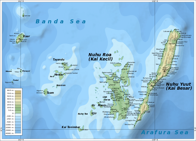
Kai Besar (Great Kai Island, also Nuhu Yuut or Nusteen) is one of the Kai Islands which are part of the Maluku Islands, Indonesia. Its area is 550 km2 (210 sq mi). The other main island in the Kai Islands group is Kai Kecil (Little Kai Island). The northern tip is called Tanjung Borang, and southern tip called Tanjung Weduar.[1]
 The Kai Islands, with Kai Besar in the east | |
Kai Besar Location on a map of the Maluku Islands | |
| Geography | |
|---|---|
| Location | Southeast Asia |
| Coordinates | 5°24′S 133°06′E / 5.40°S 133.1°E |
| Archipelago | Kai Islands |
| Administration | |
Indonesia | |
| Province | Maluku |
| Additional information | |
| Time zone | |

- ^ Prostar Sailing Directions 2004 New Guinea Enroute. ProStar Publications. 1 January 2004. p. 70. ISBN 978-1-57785-569-9.
- Media related to Kai Besar at Wikimedia Commons