Pettis County, Missouri
Contributors to Wikimedia projects
 Article Images
Pettis County is a county located in west central U.S. state of Missouri. As of the 2020 census, the population was 42,980.[1] Its county seat is Sedalia.[2] The county was organized on January 24, 1833, and named after former U.S. Representative Spencer Darwin Pettis.
Pettis County | |
|---|---|
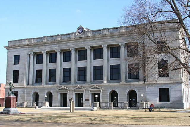
 The Pettis County Courthouse in Sedalia | |
 Location within the U.S. state of Missouri | |
 Missouri's location within the U.S. | |
| Coordinates: 38°44′N 93°17′W / 38.73°N 93.28°W | |
| Country | |
| State | |
| Founded | January 24, 1833 |
| Named for | Spencer Darwin Pettis |
| Seat | Sedalia |
| Largest city | Sedalia |
| Area | |
| • Total | 686 sq mi (1,780 km2) |
| • Land | 682 sq mi (1,770 km2) |
| • Water | 4.0 sq mi (10 km2) 0.6% |
| Population (2020) | |
| • Total | 42,980 |
| • Density | 63/sq mi (24/km2) |
| Time zone | UTC−6 (Central) |
| • Summer (DST) | UTC−5 (CDT) |
| Congressional district | 4th |
| Website | www |
Pettis County comprises the Sedalia, MO Micropolitan Statistical Area.
The county is home to the site of the Missouri State Fair in Sedalia.
According to the U.S. Census Bureau, the county has a total area of 686 square miles (1,780 km2), of which 682 square miles (1,770 km2) is land and 4.0 square miles (10 km2) (0.6%) is water.[3] It is drained by Lamine River and branches.[4]
- Saline County (north)
- Cooper County (east)
- Morgan County (southeast)
- Benton County (south)
- Henry County (southwest)
- Johnson County (west)
- Lafayette County (northwest)
| Census | Pop. | Note | %± |
|---|---|---|---|
| 1840 | 2,930 | — | |
| 1850 | 5,150 | 75.8% | |
| 1860 | 9,392 | 82.4% | |
| 1870 | 18,706 | 99.2% | |
| 1880 | 27,271 | 45.8% | |
| 1890 | 31,151 | 14.2% | |
| 1900 | 32,438 | 4.1% | |
| 1910 | 33,913 | 4.5% | |
| 1920 | 35,813 | 5.6% | |
| 1930 | 34,664 | −3.2% | |
| 1940 | 33,336 | −3.8% | |
| 1950 | 31,577 | −5.3% | |
| 1960 | 35,120 | 11.2% | |
| 1970 | 34,137 | −2.8% | |
| 1980 | 36,378 | 6.6% | |
| 1990 | 35,437 | −2.6% | |
| 2000 | 39,403 | 11.2% | |
| 2010 | 42,201 | 7.1% | |
| 2020 | 42,980 | 1.8% | |
| U.S. Decennial Census[5] 1790–1960[6] 1900–1990[7] 1990–2000[8] 2010[9] | |||
As of the census[10] of 2000, there were 39,403 people, 15,568 households, and 10,570 families residing in the county. The population density was 58 people per square mile (22 people/km2). There were 16,963 housing units at an average density of 25 units per square mile (9.7/km2). The racial makeup of the county was 92.06% White, 3.04% Black or African American, 0.38% Native American, 0.39% Asian, 0.05% Pacific Islander, 2.46% from other races, and 1.62% from two or more races. Approximately 3.88% of the population were Hispanic or Latino of any race.
There were 15,568 households, out of which 32.50% had children under the age of 18 living with them, 53.30% were married couples living together, 10.50% had a female householder with no husband present, and 32.10% were non-families. 27.00% of all households were made up of individuals, and 11.70% had someone living alone who was 65 years of age or older. The average household size was 2.49 and the average family size was 3.01.
In the county, the population was spread out, with 26.30% under the age of 18, 9.30% from 18 to 24, 27.90% from 25 to 44, 21.10% from 45 to 64, and 15.40% who were 65 years of age or older. The median age was 36 years. For every 100 females there were 94.40 males. For every 100 females age 18 and over, there were 91.70 males.
The median income for a household in the county was $31,822, and the median income for a family was $38,073. Males had a median income of $29,221 versus $19,554 for females. The per capita income for the county was $16,251. About 10.20% of families and 12.80% of the population were below the poverty line, including 16.60% of those under age 18 and 10.50% of those age 65 or over.
| Race | Num. | Perc. |
|---|---|---|
| White (NH) | 34,751 | 80.9% |
| Black or African American (NH) | 1,353 | 3.15% |
| Native American (NH) | 159 | 0.37% |
| Asian (NH) | 294 | 0.7% |
| Pacific Islander (NH) | 120 | 0.28% |
| Other/Mixed (NH) | 2,287 | 5.32% |
| Hispanic or Latino | 4,016 | 9.34% |
- Green Ridge R-VIII School District – Green Ridge
- Green Ridge Elementary School (K-06)
- Green Ridge High School (07-12)
- La Monte R-IV School District – La Monte
- La Monte Elementary School (PK-06)
- La Monte High School (07-12)
- Pettis County R-V School District – Hughesville
- Northwest Elementary School (K-06)
- Northwest High School (07-12)
- Pettis County R-XII School District – Sedalia
- Pettis County Elementary School (PK-08)
- Sedalia School District No. 200] – Sedalia
- Sedalia Early Childhood Education Center (PK)
- Heber Hunt Elementary School (K-04)
- Skyline Elementary School (K-04)
- Parkview Elementary School (K-04)
- Horace Mann Elementary School (K-04)
- Washington Elementary School (K-04)
- Sedalia Middle School (05)
- Smith-Cotton Junior High School (06-08)
- Smith-Cotton High School (9-12)
- Smithton R-VI School District – Smithton
- Smithton Elementary School (PK-06)
- Smithton High School (07-12)
- St. Paul's Lutheran School – Sedalia (PK-08) – Lutheran
- Sedalia Seventh-day Adventist School – Sedalia (01-08) – Seventh-day Adventist
- Show-Me Christian School – La Monte (K-12) – Nondenominational Christian
- Applewood Christian School – Sedalia (K-12) – Nondenominational Christian
- Sacred Heart Schools – Sedalia (K-12) – Roman Catholic
- Sacred Heart Elementary School (K-06)
- Sacred Heart High School (07-12)
- State Fair Community College – Sedalia – A public, two-year/community college.
The Republican Party predominantly controls politics at the local level in Pettis County. Republicans currently hold all but three of the elected positions in the county.
| Pettis County, Missouri | |||
|---|---|---|---|
| Elected countywide officials | |||
| Assessor | Christopher Woolery | Republican | |
| Auditor | Beverly Dillon | Republican | |
| Circuit Clerk | Susan Sadler | Republican | |
| County Clerk | Nick Lastrada | Republican | |
| Collector | Marsha L. Boeschen | Republican | |
| Commissioner (Presiding) | Bill Taylor | Republican | |
| Commissioner (District 1) | Israel Baeza | Republican | |
| Commissioner (District 2) | Jim Marcum | Republican | |
| Coroner | Robert “Skip” Smith Jr. | Republican | |
| Prosecuting Attorney | Phillip Sawyer | Republican | |
| Public Administrator | Charli Ackerman | Democratic | |
| Recorder | Barbara Clevenger | Republican | |
| Sheriff | Brad Anders | Independent | |
| Surveyor | Kerry Turpin | Democratic | |
| Treasurer | Kim Lyne | Republican | |
| Year | Republican | Democratic | Third Parties |
|---|---|---|---|
| 2020 | 71.85% 13,645 | 25.68% 4,876 | 2.47% 470 |
| 2016 | 61.95% 11,150 | 34.90% 6,281 | 3.14% 566 |
| 2012 | 47.32% 8,073 | 49.77% 8,490 | 2.91% 498 |
| 2008 | 42.55% 7,660 | 54.63% 9,834 | 2.82% 507 |
| 2004 | 57.30% 10,038 | 41.63% 7,293 | 1.06% 186 |
| 2000 | 54.65% 8,536 | 42.85% 6,692 | 2.50% 390 |
| 1996 | 44.63% 6,804 | 51.51% 7,853 | 3.86% 589 |
Pettis County is divided into four legislative districts in the Missouri House of Representatives, all of which are held by Republicans.
- District 48 — Dave Muntzel (R-Boonville). Consists of the community of Smithton and the northeast section of the county.
- District 51 — Dean Dohrman (R-La Monte). Consists of the communities of Houstonia, Hughesville, and La Monte and the northwest portion of the county.
- District 52 — Nathan Beard (R-Sedalia). Consists of the community of Sedalia.
- District 54 — Dan Houx (R-Warrensburg). Consists of the community of Green Ridge and the southern portion of the county.
All of Pettis County is a part of Missouri's 28th District in the Missouri Senate and was previously represented by Mike Parson but the seat is currently vacant.
All of Pettis County is included in Missouri's 4th Congressional District and is currently represented by Vicky Hartzler (R-Harrisonville) in the U.S. House of Representatives.
| Year | Republican | Democratic | Third party(ies) | |||
|---|---|---|---|---|---|---|
| No. | % | No. | % | No. | % | |
| 2020 | 13,854 | 72.55% | 4,783 | 25.05% | 460 | 2.41% |
| 2016 | 12,810 | 70.37% | 4,324 | 23.75% | 1,070 | 5.88% |
| 2012 | 10,842 | 63.13% | 5,904 | 34.38% | 429 | 2.50% |
| 2008 | 11,018 | 60.32% | 6,932 | 37.95% | 315 | 1.72% |
| 2004 | 11,603 | 66.32% | 5,801 | 33.16% | 92 | 0.53% |
| 2000 | 9,533 | 60.51% | 5,855 | 37.16% | 367 | 2.33% |
| 1996 | 7,336 | 48.06% | 6,057 | 39.68% | 1,872 | 12.26% |
| 1992 | 6,823 | 41.43% | 5,314 | 32.26% | 4,333 | 26.31% |
| 1988 | 9,648 | 63.47% | 5,486 | 36.09% | 66 | 0.43% |
| 1984 | 10,991 | 67.00% | 5,413 | 33.00% | 0 | 0.00% |
| 1980 | 8,833 | 55.76% | 6,475 | 40.87% | 533 | 3.36% |
| 1976 | 7,344 | 48.01% | 7,887 | 51.56% | 65 | 0.42% |
| 1972 | 10,065 | 66.74% | 5,016 | 33.26% | 0 | 0.00% |
| 1968 | 6,738 | 46.08% | 6,334 | 43.32% | 1,549 | 10.59% |
| 1964 | 5,409 | 37.57% | 8,987 | 62.43% | 0 | 0.00% |
| 1960 | 9,066 | 56.44% | 6,997 | 43.56% | 0 | 0.00% |
| 1956 | 8,766 | 55.30% | 7,086 | 44.70% | 0 | 0.00% |
| 1952 | 9,261 | 55.67% | 7,363 | 44.26% | 12 | 0.07% |
| 1948 | 6,657 | 44.18% | 8,388 | 55.66% | 24 | 0.16% |
| 1944 | 7,696 | 51.67% | 7,176 | 48.18% | 22 | 0.15% |
| 1940 | 8,905 | 50.91% | 8,570 | 48.99% | 17 | 0.10% |
| 1936 | 7,435 | 44.20% | 9,265 | 55.08% | 121 | 0.72% |
| 1932 | 5,982 | 38.48% | 9,474 | 60.95% | 89 | 0.57% |
| 1928 | 10,346 | 64.91% | 5,554 | 34.85% | 39 | 0.24% |
| 1924 | 2,656 | 55.67% | 1,826 | 38.27% | 289 | 6.06% |
| 1920 | 8,595 | 55.98% | 6,561 | 42.73% | 199 | 1.30% |
| 1916 | 4,319 | 46.42% | 4,665 | 50.13% | 321 | 3.45% |
| 1912 | 2,423 | 30.28% | 3,771 | 47.12% | 1,809 | 22.60% |
| 1908 | 3,983 | 49.39% | 3,791 | 47.01% | 290 | 3.60% |
| 1904 | 3,820 | 51.38% | 3,346 | 45.00% | 269 | 3.62% |
| 1900 | 3,824 | 48.88% | 3,820 | 48.82% | 180 | 2.30% |
| 1896 | 4,119 | 48.65% | 4,267 | 50.40% | 81 | 0.96% |
| 1892 | 3,610 | 48.02% | 3,680 | 48.95% | 228 | 3.03% |
| 1888 | 3,393 | 48.90% | 3,369 | 48.56% | 176 | 2.54% |
- Green Ridge
- Houstonia
- Hughesville
- Ionia
- La Monte
- Sedalia (county seat)
- Smithton
- Windsor
Unincorporated Communities
- ^ "Pettis County, Missouri". United States Census Bureau. Retrieved June 14, 2023.
- ^ "Find a County". National Association of Counties. Retrieved June 7, 2011.
- ^ "2010 Census Gazetteer Files". United States Census Bureau. August 22, 2012. Archived from the original on October 21, 2013. Retrieved November 18, 2014.
- ^ "Pettis" . The American Cyclopædia. 1879.
- ^ "U.S. Decennial Census". United States Census Bureau. Retrieved November 18, 2014.
- ^ "Historical Census Browser". University of Virginia Library. Retrieved November 18, 2014.
- ^ "Population of Counties by Decennial Census: 1900 to 1990". United States Census Bureau. Retrieved November 18, 2014.
- ^ "Census 2000 PHC-T-4. Ranking Tables for Counties: 1990 and 2000" (PDF). United States Census Bureau. Archived (PDF) from the original on March 27, 2010. Retrieved November 18, 2014.
- ^ "State & County QuickFacts". United States Census Bureau. Archived from the original on June 7, 2011. Retrieved September 12, 2013.
- ^ "U.S. Census website". United States Census Bureau. Retrieved January 31, 2008.
- ^ "P2 HISPANIC OR LATINO, AND NOT HISPANIC OR LATINO BY RACE – 2020: DEC Redistricting Data (PL 94-171) – Pettis County, Missouri".
- ^ Breeding, Marshall. "Boonslick Regional Library". Libraries.org. Retrieved May 8, 2017.
- ^ Breeding, Marshall. "Sedalia Public Library". Libraries.org. Retrieved May 8, 2017.
- ^ Leip, David. "Dave Leip's Atlas of U.S. Presidential Elections". uselectionatlas.org. Retrieved March 26, 2018.
- Digitized 1930 Plat Book of Pettis County Archived August 16, 2011, at the Wayback Machine from University of Missouri Division of Special Collections, Archives, and Rare Books