Johor Bahru - Wp/iba - Wikimedia Incubator
 Article Images
Content deleted Content added
Revision as of 16:38, 14 September 2024
Johor Bahru | |
|---|---|
| City of Johor Bahru Bandaraya Johor Bahru | |
| Other transcription(s) | |
| • Jawi | جوهر بهارو |
| • Chinese | 新山 (Simplified) 新山 (Traditional) Xīnshān (Hanyu Pinyin) |
| • Tamil | ஜொகூர் பாரு Jokūr Pāru (Transliteration) |
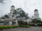
From top, left to right: | |
| Nickname(s): JB, | |
Location of Johor Bahru in Johor | |
| Lua error in Module:Wp/iba/Location_map at line 524: Unable to find the specified location map definition: "Module:Wp/iba/Location map/data/Malaysia Johor" does not exist. | |
| Coordinates: 01°27′20″N 103°45′40″E / 1.45556°N 103.76111°E | |
| Country | |
| State | Template:Wp/iba/Country data Johor |
| District | Template:Wp/iba/Country data Johor BahruJohor Bahru |
| Administrative areas | List |
| Founded | 10 March 1855 (as Tanjung Puteri) |
| Establishment of the local government | 1933 |
| Establishment of the Town Board | 1950 |
| Municipality status | 1 April 1977 |
| City status | 1 January 1994; 0 saat ke udah |
| Government | |
| • Type | City council |
| • Body | Johor Bahru City Council |
| • Mayor | Noorazam Osman |
| Pemesai | |
| • Penyampau | 391.25 km2 (151.06 sq mi) |
| Elevation | 32 m (105 ft) |
| Penyampau mensia (2020)[3] | |
| • Penyampau | 858,118 |
| • Pemadat | 2,192/km2 (5,680/sq mi) |
| Demonym | Johor Bahru |
| Time zone | UTC+8 (MST) |
| • Summer (DST) | UTC+8 (Not observed) |
| Postal code | 80xxx to 81xxx |
| Area code(s) | 07 |
| Vehicle registration | J |
| Website | www |
Johor Bahru (Malaysian: [ˈdʒohor ˈbahru]), suah dikelala enggau pemandak JB, nyadi mengeri teras Pelilih Menua Johor Bahru, enggau indu nengeri Johor, Malaysia (pelilih menua kedua pemadu besai di menua tu, nitihka penyampau tubuh).[4] Iya nyadi penyaup GDP nasional kedua pemadu besai entara mengeri besai di Malaysia,[5] lalu nyadi sebagi ari Iskandar Malaysia, zon ekonomi khas pemadu besai di menua tu, nitihka rega beranakka puku.[6] Mengeri tu ngembuan penyampau tubuh 858,118 iku enggau pemesai 391.25 km2.
Malin
- ↑ Cite error: Invalid
<ref>tag; no text was provided for refs namedtotal area - ↑ "Malaysia Elevation Map (Elevation of Johor Bahru)". Flood Map : Water Level Elevation Map. Diarkib ari asal on 22 August 2015. Diambi 22 August 2015.
- ↑ "Total population by ethnic group, Local Authority area and state, Malaysia" (PDF). Statistics Department, Malaysia. 2010. Diarkib ari asal (PDF) on 14 November 2013. Diambi 12 March 2012.
- ↑ "DOSM: Petaling district has highest population, density in 2023". www.thesundaily.my. Diambi 2023-10-25.
- ↑ "Achieving A System of Competitive Cities in Malaysia: Main Report" (PDF). World Bank Group & Khazanah Nasional. November 2015.
- ↑ Lee, Shaun (14 January 2019). "An international metropolis 13 years in the making". DHL Logistics of Things. Diambi 2023-10-27.


