Belagavi district: Difference between revisions - Wikipedia
 Article Images
Line 3:
{{original research|date=August 2017}}
}}
{{Use dmy dates|date=NovemberMay 20212024}}
{{Use Indian English |date=AugustMay 20162024}}
{{Infobox settlement
| name = Belagavi District
| other_name = Belgaum District
| settlement_type = [[List of districts of Karnataka|District]] of [[Karnataka]]
| image_skyline = {{Photomontage
|photo3a = Kamal Basti, Belgaum.jpg
|photo3b = Gokak Falls.jpg
Line 17:
|size=250
}}
| image_caption = Clockwise from top-right: [[Kamal Basadi]] in Belagavi Fort, [[Gokak Falls]], [[Navilatirtha]], [[Suvarna Vidhana Soudha]], [[Kamala Narayana Temple]]
| image_map = Karnataka Belgaum locator map.svg
| image_map1 =
| map_alt =
| map_altmap_caption = Location in = Karnataka
| coordinates = {{coord|15.85|N|74.55|E|display=inline,title}}
| map_caption = Location in Karnataka
| subdivision_type = Country
| coordinates = {{coord|15.85|N|74.55|E|display=inline,title}}
| subdivision_name = [[India]]
| subdivision_type = Country
| subdivision_namesubdivision_type1 = [[States and territories of = [[India|State]]
| subdivision_name1 = [[Karnataka]]
| subdivision_type1 = [[States and territories of India|State]]
| leader_title = [[District magistrate|Deputy Commissioner]]
| subdivision_name1 = [[Karnataka]]
| leader_title leader_name = DeputyNitesh CommissionerPatil
| leader_title2 = [[Commissioner of Police (India)| Police Commissioner]]
| leader_name = Nitesh Patil
| leader_name2 = Iada Martin Marbaniang<ref>{{cite news |title=New police commissioner for Belagavi |url=https://www.thehindu.com/news/national/karnataka/new-police-commissioner-for-belagavi/article67955555.ece |work=The Hindu |date=15 March 2024 |access-date=3 May 2024}}</ref>
| subdivision_type3 = Division
| subdivision_type3 = Division
| subdivision_name3 = [[Belagavi division]]
| subdivision_name3 = [[Belagavi division]]
| established_title = <!-- Established -->
| established_title = <!-- Established -->
| established_date =
| established_date =
| founder =
| named_for founder =
| seat_type named_for =
| seat_type = Headquarters
| seat = [[BelgaviBelgaum]]
| government_type =
| governing_body =
| unit_pref = Metric
| area_footnotes = <ref name="stats">{{cite web|title=2001 Census|url=http://Belgaum.nic.in/stat.html|publisher=Official Website of Belgaum District|access-date=4 January 2011|url-status=dead|archive-url=https://web.archive.org/web/20110721163433/http://belgaum.nic.in/stat.html|archive-date=21 July 2011}}</ref>
| unit_pref = Metric
| area_rank = 1st ([[List of districts of Karnataka|31 districts]])
| area_footnotes = <ref name="stats">{{cite web|title=2001 Census|url=http://Belgaum.nic.in/stat.html|publisher=Official Website of Belgavi District|access-date=4 January 2011|url-status=dead|archive-url=https://web.archive.org/web/20110721163433/http://belgaum.nic.in/stat.html|archive-date=21 July 2011}}</ref>
| area_total_km2 = 13415
| area_rank = 1<sup>st</sup>([[List of districts of Karnataka|31 districts]])
| elevation_footnotes =
| area_total_km2 = 13415
| elevation_footnotes elevation_m =
| population_total = 4,779,661
| elevation_m =
| population_as_of = 2011
| population_total = 4,779,661
| population_rank =
| population_as_of = 2011
| population_density_km2 = auto
| population_rank =
| population_footnotes = <ref name="stats"/>
| population_density_km2 = auto
| demographics_type1 = Languages
| population_footnotes = <ref name="stats"/>
| demographics1_title1 = Official
| demographics_type1 = Languages
| demographics1_info1 = [[Kannada]]
| demographics1_title1 = Official
| demographics1_info1 timezone1 = [[KannadaIndian Standard Time|IST]]
| utc_offset1 = +5:30
| timezone1 = [[Indian Standard Time|IST]]
| postal_code_type = <!-- [[Postal Index Number|PIN]] -->
| utc_offset1 = +5:30
| postal_code =
| postal_code_type = <!-- [[Postal Index Number|PIN]] -->
| registration_plate = * [[Belgaum]] KA-22
| postal_code =
| registration_plate = * [[Belgavi]] KA-22
* [[Chikodi]] KA-23
* [[Bailhongal]] KA-24
Line 63 ⟶ 65:
* [[Ramdurg]] KA-69
* [[Athani, Belagavi|Athani]] KA-71
| blank1_name_sec1 = [[Human sex ratio|Sex ratio]]
| blank1_info_sec1 = 1.04 [[male|♂]]/[[female|♀]]
| blank2_name_sec1 = Literacy
| blank2_info_sec1 = 64.2%
| blank1_name_sec2 = [[Precipitation (meteorology)|Precipitation]]
| blank1_info_sec2 = {{convert|823|mm|in}}
| website = {{URL|belagavi.nic.in/}}
| iso_code = [[ISO 3166-2:IN|IN-KA]]
| footnotes =
| population_demonym = Belgaumites,<ref>{{cite book |last1=Sabharwal |first1=Gopa |title=Ethnicity and Class: Social Divisions in an Indian City |date=2006 Belagavians|publisher=Oxford <ref>{{CiteUniversity webPress |agencyisbn=TNN978-0-19-567830-7 |datepage=31232 August|url=https://books.google.com/books?id=gEhPAAAAMAAJ&q=Belgaumites 2019|language=en}}</ref> Belagavians <ref>{{Cite news |title=Belagavians take the lead to get rid of potholes |department=Hubballi News |url=https://timesofindia.indiatimes.com/city/hubballi/belagavians-take-the-lead-to-get-rid-of-potholes/articleshow/70910713.cms |access-date=2022-11-18 |website=The Times of India |languagedate=en31 August 2019 |access-date=18 November 2022}}</ref>
}}
'''Belagavi district''', formerly also known as also '''Belgaum district''',<ref name=indianexpress>{{cite news|title=Belgaum becomes Belagavi, as Centre clears name change plan|url=https://indianexpress.com/article/india/india-others/centre-clears-name-change-plan-belgaum-is-now-belagavi/ |access-date=30 August 2020|work=The Indian Express|date=18 October 2014|language=en}}</ref> is a district in the state of [[Karnataka]], India. The district is known as ''Sugarthe sugar Bowlbowl of Karnataka'' with 1.5 lakh ({{lakh |1.5}}) hectares being used for commercial production.<ref name=kum.kar>{{cite web|title=Belagavi - foundry hub of North Karnataka|url=https://kum.karnataka.gov.in/KUM/PDFS/DistrictProfile/Belagavi.pdf|website=karnataka.gov.in|accessdate=14 March 2021|archive-date=13 December 2019|archive-url=https://web.archive.org/web/20191213192914/https://kum.karnataka.gov.in/KUM/PDFS/DistrictProfile/Belagavi.pdf|url-status=dead}}</ref> and itIt has displacedovertaken [[Mandya district]] in sugar canesugarcane production over the last decade.<ref>{{Cite news|url=https://www.hindustantimes.com/india-news/karnataka-elections-the-jarkiholi-brothers-belagavi-s-sugar-baron-politicians/story-r0JyjzV62OEnCxqDBSKraO.html|title=Karnataka elections: Meet the five brothers from Belagavi who are contesting against each other|date=4 May 2018|work=Hindustan Times|language=en|access-date=19 January 2020}}</ref> The city of [[Belgaum]] (Belagavi) is the district headquarters in Belagavi district. It houses the [[Suvarna Vidhana Soudha|Second legislative building]], where the Karnataka Legislature holdholds session once a year. The district is famous for its native sweet, Kunda. According to the 2011 Census of India, it has a population of 4,779,661, of which 24.03% live in urban areas,<ref>{{cite web|url=http://www.censusindiamaps.net/page/India_WhizMap/IndiaMap.htm |title=Census GIS India |access-date=27 August 2009 |url-status=dead |archive-url=https://web.archive.org/web/20100111052456/http://www.censusindiamaps.net/page/India_WhizMap/IndiaMap.htm |archive-date=11 January 2010 }}</ref> making it the second most populous district in Karnataka (out of [[List of districts in Karnataka|31]]), after [[Bangalore Urban district|Bangalore Urban]].<ref name="districtcensus">{{Cite web |date=2011 |title=District Census Handbook: Belagavi |url=https://censusindia.gov.in/nada/index.php/catalog/588/download/2000/DH_2011_2901_PART_A_DCHB_BELGAUM.pdf |website=censusindia.gov.in |publisher=[[Registrar General and Census Commissioner of India]]}}</ref> The district has an area of {{cvt|13,415|km2}}, making it the largest district in terms of size in Karnataka, andIt is bounded by [[Kolhapur district|Kolhapur District]] and [[Sangli district]] of [[Maharashtra]] state on the west and north, on the northeast by [[Bijapur district, Karnataka|Bijapur district]], on the east by [[Bagalkot district]], on the southeast by [[Gadag district]], on the south by [[Dharwad district|Dharwad]] and [[Uttara Kannada]] districts, and on the southwest by the state of [[Goa]].
==History==
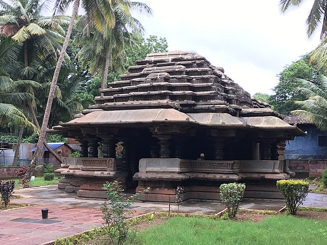
[[File:Halasi 12.jpg|thumb|left|'''Bhuvaraha Narasimha temple''' Halasi, [[Karnataka]]]]
[[File:Panchalingeshwara temple.JPG|thumb|left| Panchalingeshwara temple Hooli]]
Belgaum is the Divisional Headquarters of [[North Karnataka]]. The original name of the town of Belgaum was Venugrama, meaning ''Bamboo Village''. It is also known as Malnad Pradesh. The most ancient place in the district is [[Halasi|Halsi]]; and this, according to inscriptions on [[Indian copper plate inscriptions|copper plates]] discovered in its neighborhoodneighbourhood, was once the capital of a dynasty of nine [[Kadambas|Kadamba]] kings. It appears that from the middle of the 6th century to about 760 the area was held by the [[Chalukya]]s, who were succeeded by the [[Rashtrakuta]]s. After the break-up of the Rashtrakuta dynasty a portion of it survived in the [[Ratta dynasty|Rattas]] (875–1250), who from 1210 onward made Venugrama their capital. Inscriptions give evidence of a long struggle between the Rattas and the [[Halasi#Kadamba dynasty|Kadamba]]s of [[Goa]], who succeeded in the latter years of the 12th century in acquiring and holding part of the district. By 1208, however, the Kadambas had been overthrown by the Rattas, who in their turn succumbed to the [[Yadavas of Devagiri]] in 1250. After the overthrow of the Yadavas by the [[Delhi Sultanate]] (1320), Belgaum was for a short time under the rule of the latter; but only a few years later the part south of the [[Ghataprabha River]] was subject to the Hindu rajas of [[Vijayanagara]]. In 1347 the northern part was conquered by the [[Bahmani Sultanate]], which in 1473 took the town of Belgaum and conquered the southern part also. When [[Aurangzeb]] overthrew the [[Bijapur Sultanate|Bijapura]] sultans in 1686, Belgaum passed to the [[Mughal Empire|Mughals]]. In 1776 the country was overrun by [[Hyder Ali]] of [[Kingdom of Mysore|Mysore]], but was taken by the [[Madhavrao Peshwa]] . In 1818 it was handed over to the [[British East India Company]], and was made part of the district of [[Dharwad district|Dharwar]]. In 1836 this was divided into two parts, the northern district becoming Belgaum.<ref name="EB1911">{{EB1911|inline=1|wstitle=Belgaum|volume=3|page=668}}</ref>
[[Yadur]] is situated beside the [[Krishna riverRiver]], and there is a famous Veerbhadra temple there. Many devotees visit the area from Karnataka and Maharashtra. [[Hooli]] is one of the oldest villages in Belgaum district. There are many [[Chalukya]] temples in the village, including the famous Panchaligeswara temple.
[[Kittur]] in Belgaum district is a place of historical importance. [[Rani Chennamma]] of Kittur (1778–1829) is known for her resistance to British rule.
The British had a sizablesizeable infantry post here, having realised the military importance of its geographic location. It is one of the reasons for Belgaum's sobriquet ''The Cradle of Infantry''. Development of a rail network for the movement of resources and later troops was one of the means employed by both the British East India Company and the British to exert control over India. Belgaum's railway station, the [[Mahatma Gandhi]] Railway Station was established by the British. A signboard declaring the sobriquet can be seen hung on Platform 1 at the station.
===Border dispute===
Line 94 ⟶ 96:
In accordance with the established policy of bifurcation on a linguistic majority basis, in 1956, the [[Belgaum district]] was incorporated into the newly formed [[Mysore state]] (now [[Karnataka]]) with the passage of the [[States Reorganization Act]], adjoining areas that had a majority of Marathi speaking citizens were included in the newly formed [[Maharashtra]] state.<ref>{{cite web|url=http://www.articlearchives.com/north-america/united-states-southeast-usa/1856354-1.html|archive-url=https://web.archive.org/web/20120512003413/http://www.articlearchives.com/north-america/united-states-southeast-usa/1856354-1.html|url-status=dead|archive-date=12 May 2012|title=DomainMarket.com, The world's best brand new brands}}</ref><ref>{{cite news |author= Jaishankar Jayaramiah |title = Karnataka caught in 'language' web |url = http://www.financialexpress.com/fe_full_story.php?content_id=109230 |publisher=The Financial express |date= 21 November 2005 |access-date = 1 November 2006 |archive-url = https://web.archive.org/web/20070310192251/http://www.financialexpress.com/fe_full_story.php?content_id=109230 |archive-date = 10 March 2007|url-status= dead |df = dmy-all}}</ref>
==Geography==
==Administrative divisions==
===Water bodies===
The administration of Belgaum district has been divided into 15 [[taluk]]s.
{{cmn|colwidth=20em|rules=yes|
* [[Belgaum]]
* [[Bailhongal]]
* [[Chikkodi]]
* [[Gokak]]
* [[Hukkeri]]
* [[Raybag]]
* [[Ramdurg taluka|Ramdurg]]
* [[Athani, Belagavi|Athani]]
* [[Saundatti]]
* [[Khanapur]]
* [[Kittur]]
* [[Nippani]]
* [[Kagwad Assembly constituency|Kagawad]]
* [[Mudalagi]]
* [[Yaragatti]]
}}
[[Athani taluk]] is the largest with an area of 1,997.70 km<sup>2</sup> and Raybag taluk is the smallest with an area of 958.8 km<sup>2</sup>. The district comprises three revenue sub-divisions headquartered at [[Belgaum]], [[Bailhongal]] and [[Chikodi]] governed by an [[assistant commissioner (revenue)|assistant commissioner]] and taluks headed by [[Tehsildar]]<ref>{{cite web|url=https://belagavi.nic.in/en/tehsil/|title=Sub Divisions and Talukas {{!}} District Belagavi, Government of Karnataka {{!}} India|language=en-US|access-date=18 January 2020}}</ref> and has six police sub-divisions. Apart from the Belgaum City Corporation, there are 17 municipalities, 20 towns, 485 [[gram panchayat]]s, 1,138 inhabited villages and 26 non-inhabited villages. Belgaum is also the headquarters of the Belgaum Revenue
==Villages==
<!---♦♦♦ Only add a location to this list if they already have their own article on the English Wikipedia ♦♦♦--->
<!---♦♦♦ Please keep the list in alphabetical order ♦♦♦--->
*[[Karwaish]]
==Water bodies==
List of rivers flowing through Belgaum District
* [[Krishna River|Krishna]]
* [[Malaprabha]]
* [[Ghataprabha]]
* Vedhganga
* [[Dudhaganga|Doodhganga]]
* [[Mahadayi]]
* Pandari
Line 139 ⟶ 114:
|title=2010 Resident Population Data
|publisher=U. S. Census Bureau
|access-date=30 September 2011 |quote=Alabama 4,779,736
|quote=Alabama 4,779,736
|url-status=dead
|archive-url=https://web.archive.org/web/20131019160532/http://2010.census.gov/2010census/data/apportionment-pop-text.php
|archive-date=19 October 2013 }}</ref> This gives it a ranking of 25th in India (out of a total of [[Districts of India|640]]).<ref name=districtcensus/> The district has a population density of {{convert| 356 |PD/sqkm|PD/sqmi}}.<ref name=districtcensus/> Its [[Family planning in India|population growth rate]] over the decade 2001–2011 was 13.38%.<ref name=districtcensus/> There were 969 [[Women in India|females]] for every 1000 males,<ref name=districtcensus/> and a [[Literacy in India|literacy rate]] of 73.94%. 25.34% of the population lives in urban areas. Scheduled Castes and Scheduled Tribes make up 12.08% and 6.22% of the population respectively.<ref name=districtcensus/>
|archive-date=19 October 2013
}}</ref> This gives it a ranking of 25th in India (out of a total of [[Districts of India|640]]).<ref name=districtcensus/> The district has a population density of {{convert| 356 |PD/sqkm|PD/sqmi}}.<ref name=districtcensus/> Its [[Family planning in India|population growth rate]] over the decade 2001–2011 was 13.38%.<ref name=districtcensus/> There were 969 [[Women in India|females]] for every 1000 males,<ref name=districtcensus/> and a [[Literacy in India|literacy rate]] of 73.94%. 25.34% of the population lives in urban areas. Scheduled Castes and Scheduled Tribes make up 12.08% and 6.22% of the population respectively.<ref name=districtcensus/>
{{bar box
Line 171 ⟶ 144:
At the time of the 2011 census, 68.40% of the population spoke [[Kannada]], 18.70% [[Marathi language|Marathi]] and 9.79% [[Urdu]] as their first language.<ref name="languages">{{Cite web |title=Table C-16 Population by Mother Tongue: Karnataka |url=https://censusindia.gov.in/nada/index.php/catalog/10208/download/13320/DDW-C16-STMT-MDDS-2900.XLSX |website=www.censusindia.gov.in |publisher=[[Registrar General and Census Commissioner of India]]}}</ref>
==Government and politics==
==Education==
===Administrative divisions===
Belgaum district is a home to three universities: [[Visvesvaraya Technological University]], [[Rani Channamma University, Belagavi]] and [[KLE University]]. Also, it has a nine engineering colleges, two medical colleges, two dental colleges, 15 polytechnics, 7 Indian system of medical colleges, and 180 degree colleges.<ref>{{cite web |title=Belagavi District |url=https://www.investkarnataka.co.in/district-profiles-belagavi |website=www.investkarnataka.co.in |access-date=13 December 2019 |archive-date=13 December 2019 |archive-url=https://web.archive.org/web/20191213185818/https://www.investkarnataka.co.in/district-profiles-belagavi |url-status=dead }}</ref>
The administration of Belgaum district has been divided into 15 [[taluk]]s.
{{cmn|colwidth=20em|rules=yes|
* [[Belgaum]]
* [[Bailhongal]]
* [[Chikkodi]]
* [[Gokak]]
* [[Hukkeri]]
* [[Raybag]]
* [[Ramdurg taluka|Ramdurg]]
* [[Athani, Belagavi|Athani]]
* [[Saundatti]]
* [[Khanapur]]
* [[Kittur]]
* [[Nippani]]
* [[Kagwad Assembly constituency|Kagawad]]
* [[Mudalagi]]
* [[Yaragatti]]
}}
[[Athani taluk]] is the largest with an area of 1,997.70 km<sup>2</sup> and Raybag taluk is the smallest with an area of 958.8 km<sup>2</sup>. The district comprises three revenue sub-divisions headquartered at [[Belgaum]], [[Bailhongal]] and [[Chikodi]] governed by an [[assistant commissioner (revenue)|assistant commissioner]] and taluks headed by [[Tehsildar]]<ref>{{cite web|url=https://belagavi.nic.in/en/tehsil/|title=Sub Divisions and Talukas {{!}} District Belagavi, Government of Karnataka {{!}} India|language=en-US|access-date=18 January 2020}}</ref> and has six police sub-divisions. Apart from the Belgaum City Corporation, there are 17 municipalities, 20 towns, 485 [[gram panchayat]]s, 1,138 inhabited villages and 26 non-inhabited villages.
====Villages====
<!---♦♦♦ Only add a location to this list if they already have their own article on the English Wikipedia ♦♦♦--->
<!---♦♦♦ Please keep the list in alphabetical order ♦♦♦--->
*[[Karwaish]]
===Politics===
{{transcluded section|source=16th Karnataka Assembly}}
{{#section:16th Karnataka Assembly|MLA Header}}
{{#section:16th Karnataka Assembly|Belagavi district}}
|}
==Industry==
The district has seven industrial areas, one [[special economic zone]] (SEZ) (India's first precision engineering SEZ with more than 200 acres) and 16 industrial estates.<ref name=kum.kar/> The city's industrial growth begin when Babu Rao Pusalkar set up a small unit in city over a century ago and that transformed Belgaum city into foundry and hydraulics base.<ref name=thehindubusinessline>{{cite news |last1=URS |first1=ANIL |title=Belagavi: A city on the frontlines reinvents itself |url=https://www.thehindubusinessline.com/specials/belagavi-a-city-on-the-frontlines-reinvents-itself/article8310110.ece |access-date=14 December 2019 |work=@businessline |language=en}}</ref>
{| class="wikitable" style="display: inline-table;"
|-
Line 194 ⟶ 198:
| Kanagala || 848.00
|}
{| class="wikitable" style="display: inline-table;"
|-
Line 233 ⟶ 238:
|}
List of industrial clusters in Belgaum district that are identified by Ministry of Micro, Small and Medium Enterprises<ref>{{cite web |title=KARNATAKAKarnataka STATEState INDUSTRIALIndustrial PROFILEProfile 2015-2016 |website=dcmsme.gov.in | url=http://dcmsme.gov.in/dips/state_wise_dips/state_profile_karnatka_11316.pdf |access-date=13 December 2019}}</ref>
{| class="wikitable"
|-
Line 258 ⟶ 263:
| Gokak || Dolls & Toys
|}
==Education==
Belgaum district is a home to three universities: [[Visvesvaraya Technological University]], [[Rani Channamma University, Belagavi]] and [[KLE University]]. Also, it has a nine engineering colleges, two medical colleges, two dental colleges, 15 polytechnics, 7 Indian system of medical colleges, and 180 degree colleges.<ref>{{cite web |title=Belagavi District |url=https://www.investkarnataka.co.in/district-profiles-belagavi |website=www.investkarnataka.co.in |access-date=13 December 2019 |archive-date=13 December 2019 |archive-url=https://web.archive.org/web/20191213185818/https://www.investkarnataka.co.in/district-profiles-belagavi |url-status=dead }}</ref>
==Notable people==
Line 263 ⟶ 271:
<!---♦♦♦ Please keep the list in alphabetical order by LAST NAME ♦♦♦--->
{{div col}}
* [[Suresh Angadi]] - Former Railway Minister
* [[S. Ballesh]] – [[Shehnai]] artist
* [[Hemant Birje]] – actor
Line 270 ⟶ 279:
* [[Kumar Gandharva]] – classical singer
* [[Balappa Hukkeri]] – singer
* [[Satish Jarkiholi]] - [[Indian National Congress]] politician, Minister of Public Works Department in [[Government of Karnataka]]
* [[Shamba Joshi]] – writer
* [[Kaka Kalelkar]] (1885–1981) – independence activist
Line 285 ⟶ 295:
* [[Pramod Muthalik]] – chief of [[Sri Ram Sena]], politician
* [[Bandu Patil]] – hockey player
* [[V. L. Patil]] - politician, industrialist, and freedom fighter
* [[D. C. Pavate]] – Indian Mathematician
* [[Charan Raj]] – Indian actor
* [[Sangolli Rayanna]] – freedom fighter
* [[Raja Lakhamagouda Sardesai]] – ruler of Vantmuri princely state
* [[Laxman Savadi]] - Deputy Chief Minister of Karnataka
* [[Shantisagar|Acharya Shantisagar]] – Jain Digambara monk
* [[Shri Thanedar]] – Indian-American politician, businessman, scientist