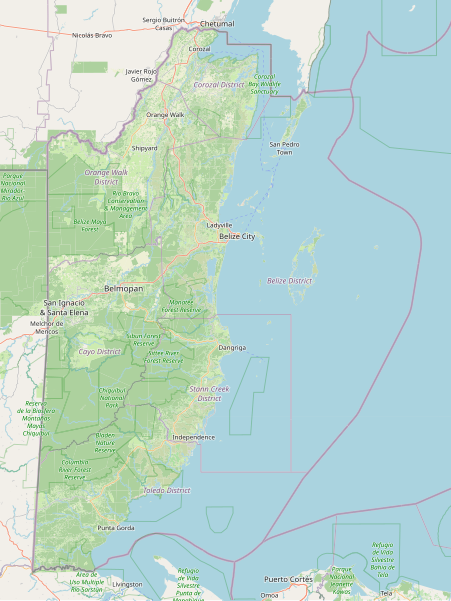
File:OpenStreetMap Belize.svg - Wikipedia
 Article Images
Original file (SVG file, nominally 899 × 1,196 pixels, file size: 17.41 MB)
File history
Click on a date/time to view the file as it appeared at that time.
| Date/Time | Thumbnail | Dimensions | User | Comment | |
|---|---|---|---|---|---|
| current | 04:07, 3 September 2023 |  | 899 × 1,196 (17.41 MB) | CactiStaccingCrane | {{OpenStreetMap |name = OpenStreetMap Belize map |location = Belize |description = Map of Belize's landcover, major cities, protected areas, etc. Scale 1:1250000. |top = 18.625424540701264 |bottom = 15.749962572748768 |left = -89.39025878906251 |right = -87.12707519531251 |date = 3 September 2023 |authors = Dedicated to Charlie Plett, who did the impossible and mapped most of Belize's landuse. |other_versions... |
File usage
The following page uses this file:
Global file usage
The following other wikis use this file:
- Usage on sl.wikipedia.org
This file contains additional information, probably added from the digital camera or scanner used to create or digitize it.
If the file has been modified from its original state, some details may not fully reflect the modified file.
| Width | 719pt |
|---|---|
| Height | 957pt |
