Holt Town tram stop
Contributors to Wikimedia projects
 Article Images
Holt Town is a tram stop on the East Manchester Line (EML) of Greater Manchester's light-rail Metrolink system. The station opened on 11 February 2013, after a three-day free trial for local residents, as part of Phase 3a of the Metrolink's expansion.[1][2][3] It is beside the River Medlock in Holt Town, between Ancoats and Bradford.[4]
Holt Town | ||||||||||||||||||||||||||||||||||||||||||||||||||||||||||||||||||||||||||||||||||||||||||||||||||||||||||||||||||||||||||||||||||||||||||||||||||||
|---|---|---|---|---|---|---|---|---|---|---|---|---|---|---|---|---|---|---|---|---|---|---|---|---|---|---|---|---|---|---|---|---|---|---|---|---|---|---|---|---|---|---|---|---|---|---|---|---|---|---|---|---|---|---|---|---|---|---|---|---|---|---|---|---|---|---|---|---|---|---|---|---|---|---|---|---|---|---|---|---|---|---|---|---|---|---|---|---|---|---|---|---|---|---|---|---|---|---|---|---|---|---|---|---|---|---|---|---|---|---|---|---|---|---|---|---|---|---|---|---|---|---|---|---|---|---|---|---|---|---|---|---|---|---|---|---|---|---|---|---|---|---|---|---|---|---|---|---|
| Metrolink station | ||||||||||||||||||||||||||||||||||||||||||||||||||||||||||||||||||||||||||||||||||||||||||||||||||||||||||||||||||||||||||||||||||||||||||||||||||||
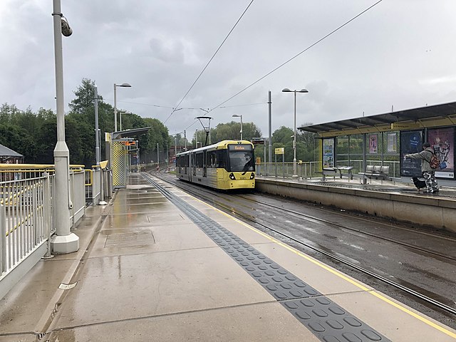
 Holt Town tram stop in May 2019. | ||||||||||||||||||||||||||||||||||||||||||||||||||||||||||||||||||||||||||||||||||||||||||||||||||||||||||||||||||||||||||||||||||||||||||||||||||||
| General information | ||||||||||||||||||||||||||||||||||||||||||||||||||||||||||||||||||||||||||||||||||||||||||||||||||||||||||||||||||||||||||||||||||||||||||||||||||||
| Location | Holt Town, Manchester England | |||||||||||||||||||||||||||||||||||||||||||||||||||||||||||||||||||||||||||||||||||||||||||||||||||||||||||||||||||||||||||||||||||||||||||||||||||
| Coordinates | 53°29′00″N 2°12′43″W / 53.48329°N 2.21205°W | |||||||||||||||||||||||||||||||||||||||||||||||||||||||||||||||||||||||||||||||||||||||||||||||||||||||||||||||||||||||||||||||||||||||||||||||||||
| Line(s) | East Manchester Line | |||||||||||||||||||||||||||||||||||||||||||||||||||||||||||||||||||||||||||||||||||||||||||||||||||||||||||||||||||||||||||||||||||||||||||||||||||
| Platforms | 2 | |||||||||||||||||||||||||||||||||||||||||||||||||||||||||||||||||||||||||||||||||||||||||||||||||||||||||||||||||||||||||||||||||||||||||||||||||||
| Other information | ||||||||||||||||||||||||||||||||||||||||||||||||||||||||||||||||||||||||||||||||||||||||||||||||||||||||||||||||||||||||||||||||||||||||||||||||||||
| Status | In operation | |||||||||||||||||||||||||||||||||||||||||||||||||||||||||||||||||||||||||||||||||||||||||||||||||||||||||||||||||||||||||||||||||||||||||||||||||||
| Fare zone | 2 | |||||||||||||||||||||||||||||||||||||||||||||||||||||||||||||||||||||||||||||||||||||||||||||||||||||||||||||||||||||||||||||||||||||||||||||||||||
| History | ||||||||||||||||||||||||||||||||||||||||||||||||||||||||||||||||||||||||||||||||||||||||||||||||||||||||||||||||||||||||||||||||||||||||||||||||||||
| Opened | 8 February 2013 (preview)[1] 11 February 2013(full)[2][3] | |||||||||||||||||||||||||||||||||||||||||||||||||||||||||||||||||||||||||||||||||||||||||||||||||||||||||||||||||||||||||||||||||||||||||||||||||||
| Original company | Metrolink | |||||||||||||||||||||||||||||||||||||||||||||||||||||||||||||||||||||||||||||||||||||||||||||||||||||||||||||||||||||||||||||||||||||||||||||||||||
| ||||||||||||||||||||||||||||||||||||||||||||||||||||||||||||||||||||||||||||||||||||||||||||||||||||||||||||||||||||||||||||||||||||||||||||||||||||
| ||||||||||||||||||||||||||||||||||||||||||||||||||||||||||||||||||||||||||||||||||||||||||||||||||||||||||||||||||||||||||||||||||||||||||||||||||||

Services
Services run every 12 minutes on each route.
| Preceding station | Manchester Metrolink | Following station | ||
|---|---|---|---|---|
| New Islington towards Eccles |
Eccles–Ashton (peak only) | Etihad Campus towards Ashton-under-Lyne | ||
| Eccles–Ashton via MediaCityUK (off-peak only) | ||||
| New Islington towards Altrincham |
Altrincham–Etihad Campus (evenings and Sundays only) | Etihad Campus Terminus | ||
| New Islington towards MediaCityUK |
MediaCityUK–Etihad Campus (peak only) | |||
Connecting bus routes
Holt Town is served by Stagecoach Manchester services 216 and 231, which both stop nearby on Ashton New Road. Service 216 replicates the tram route between Piccadilly Gardens and Droylsden before continuing to Ashton-under-Lyne, while the 231 runs from Manchester to Ashton via Littlemoss and Smallshaw.[5]
References
- ^ a b "It's the final countdown". Transport for Greater Manchester. 1 February 2013. Archived from the original on 22 October 2013. Retrieved 7 February 2013.
- ^ a b Kirby, Dean (4 December 2012). "Opening of Metrolink tram service to Droylsden delayed until February 2013". Archived from the original on 7 December 2012. Retrieved 7 December 2012.
- ^ a b "Droylsden's new Metrolink line to open in February". Transport for Greater Manchester. 7 December 2012. Archived from the original on 22 October 2013. Retrieved 7 December 2012.
- ^ "Metrolink - Holt Town station" (PDF). Transport for Greater Manchester. Retrieved 26 June 2011.
- ^ "Transport for Greater Manchester - Journey Planning - Network Maps". Transport for Greater Manchester. Archived from the original on 2 November 2012. Retrieved 13 February 2013.
External links
Wikimedia Commons has media related to Holt Town Metrolink station.
Manchester railways |
|---|
City Centre and North |
This article on a railway station in Greater Manchester is a stub. You can help Wikipedia by expanding it. |
This United Kingdom rapid transit article is a stub. You can help Wikipedia by expanding it. |