| Crossing
|
Image
|
Carries
|
Location
|
Built
|
Coordinates
|
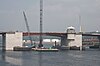
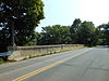
| Charles M. Braga, Jr. Bridge
|

|
 I-195 I-195
|
Somerset to Fall River
|
1966
|
41°42′23.62″N 71°09′56.51″W / 41.7065611°N 71.1656972°W
|
| Slade's Ferry Bridge (demolished 1970)
|
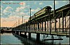
|
originally rail and road traffic
|
1875
|
41°43′14.99″N 71°9′31.00″W / 41.7208306°N 71.1586111°W[1]
|
| Brightman Street Bridge (closed to all traffic in 2011)
|
|
formerly carried   US 6 / Route 138 US 6 / Route 138
|
1908
|
41°43′26.26″N 71°09′20.51″W / 41.7239611°N 71.1556972°W
|
| Veterans Memorial Bridge
|
|
US 6 / Route 138
|
2011
|
41°43′35.18″N 71°9′6.24″W / 41.7264389°N 71.1517333°W
|
| rail bridge (demolished)
|
|
|
|
41°46′12″N 71°07′13″W / 41.77000°N 71.12028°W
|
| temporary Bailey bridge (removed 2015)
|

|
Elm Street (Berkley)
Center Street (Dighton)
|
Berkley and Dighton
|
2009
|
41°50′05.55″N 71°06′29.71″W / 41.8348750°N 71.1082528°W
|
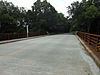
| Berkley–Dighton Bridge
|

|
Elm Street (Berkley)
Center Street (Dighton)
|
Berkley and Dighton
|
2015
|
41°50′05.83″N 71°06′29.28″W / 41.8349528°N 71.1081333°W
|
| Berkley-Dighton Bridge (demolished 2010)
|

|
Elm Street (Berkley)
Center Street (Dighton)
|
Berkley and Dighton
|
1896
|
41°50′05.83″N 71°06′29.28″W / 41.8349528°N 71.1081333°W
|
| Weir Bridge
|
|
Plain Street
|
Taunton
|
1953
|
41°53′09.89″N 71°05′20.62″W / 41.8860806°N 71.0890611°W
|
| rail bridge (off Ingell Street, Weir Village)
|
|
Middleboro Subdivision
|
|
41°53′15.29″N 71°05′05.28″W / 41.8875806°N 71.0848000°W
|
| Edward McCarthy Memorial Bridge
|
|
 Route 140 (County Street) Route 140 (County Street)
|
1972
|
41°53′48.30″N 71°04′53.76″W / 41.8967500°N 71.0816000°W
|
| rail bridge (off County Street)
|

|
Massachusetts Coastal Railroad
|
|
41°54′00.65″N 71°04′59.63″W / 41.9001806°N 71.0832306°W
|
| rail bridge (off Dean Street)
|

|
Massachusetts Coastal Railroad
|
|
41°54′12.85″N 71°04′54.64″W / 41.9035694°N 71.0818444°W
|
| John Joseph Donahue Memorial Bridge
|
|
Honorable Gordon Owen Riverway
|
1975
|
41°54′11.77″N 71°04′32.38″W / 41.9032694°N 71.0756611°W
|
| Harris Street Bridge
|
|
closed
|
1887
|
41°54′20.12″N 71°04′09.74″W / 41.9055889°N 71.0693722°W
|
| Route 24 bridge
|

|
 Route 24 Route 24
|
Raynham
|
|
41°54′06.12″N 71°02′42.90″W / 41.9017000°N 71.0452500°W
|
Old Colony Avenue (East Taunton)
South Street East (Raynham)
|

|
|
Taunton and Raynham
|
1945
|
41°53′09.56″N 71°01′48.07″W / 41.8859889°N 71.0300194°W
|
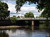
| Church Street Bridge
|

|
Church Street
|
Raynham
|
1977
|
41°53′37.06″N 71°00′10.54″W / 41.8936278°N 71.0029278°W
|
| SFC Jared C. Monti Bridge
|
|
 US 44 US 44
|
Taunton and Raynham
|
|
41°54′11.59″N 70°59′44.88″W / 41.9032194°N 70.9958000°W
|
| I-495
|
|
 I-495 I-495
|
Middleborough and Raynham
|
|
41°55′25.00″N 70°59′47.82″W / 41.9236111°N 70.9966167°W
41°55′25″N 70°59′48″W / 41.92361°N 70.996616°W
|
| World War I Veterans Memorial Bridge (aka Pratts Bridge)[2]
|

|
Vernon Street
|
Middleborough and Bridgewater
|
1956
|
41°55′56.49″N 70°59′35.07″W / 41.9323583°N 70.9930750°W
|
| World War II Veterans Memorial Bridge (aka Sturtevant Bridge)[3]
|
|
Plymouth Street in North Middleboro./ Green Street
|
|
41°56′10.74″N 70°59′14.21″W / 41.9363167°N 70.9872806°W
|
| Desert Storm Veterans Memorial Bridge
|

|
  Route 18 / Route 28 Route 18 / Route 28
|
2007
|
41°56′12.24″N 70°57′56.26″W / 41.9367333°N 70.9656278°W
|
| Titicut Street Bridge
|
|
Titicut Street
|
|
41°56′02.38″N 70°57′23.47″W / 41.9339944°N 70.9565194°W
|
| rail bridge
|
|
|
|
41°56′20.57″N 70°56′25.69″W / 41.9390472°N 70.9404694°W
|
| Vietnam Veterans Memorial Bridge (aka Woodward Bridge)
|

|
Summer Street
|
2012
|
41°56′50.99″N 70°56′11.55″W / 41.9474972°N 70.9365417°W
|
| Auburn Street Bridge (ruin)
|
|
Auburn Street
|
|
41°57′47.70″N 70°54′44.10″W / 41.9632500°N 70.9122500°W
|
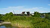
| Childs Bridge
|
|
Cherry Street
|
Bridgewater and Halifax
|
|
41°58′42.48″N 70°54′43.73″W / 41.9784667°N 70.9121472°W
|
| Plymouth Street
|
|
 Route 104 Route 104
|
Bridgewater
|
|
41°59′33.29″N 70°56′23.46″W / 41.9925806°N 70.9398500°W
|
.jpg)


.JPG)


.jpg)
.JPG)
.JPG)
.JPG)


.jpg)