Sehore district
Contributors to Wikimedia projects
 Article Images
This article is about the district. For its eponymous headquarters, see Sehore.
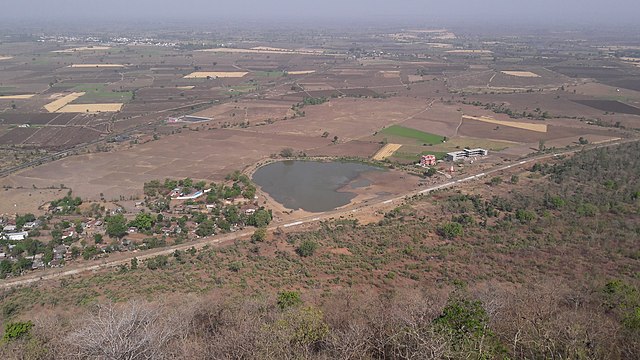
Sehore District is a district of Madhya Pradesh state in central India. The town of Sehore is the district headquarters. The district is part of Bhopal Division.
Sehore District | |
|---|---|
Salkanpur Temple
right 👉 :Stupas in Saru Maru, Panguraria | |
 Location of Sehore district in Madhya Pradesh | |
| Coordinates (Sehore): 23°12′N 77°05′E / 23.200°N 77.083°E | |
| Country | India |
| State | Madhya Pradesh |
| Division | Bhopal |
| Headquarters | Sehore |
| Tehsils | 8: |
| Government | |
| • Lok Sabha constituencies | Bhopal |
| Area | |
| • Total | 6,578 km2 (2,540 sq mi) |
| Population (2011) | |
| • Total | 1,311,332 |
| • Density | 200/km2 (520/sq mi) |
| Demographics | |
| • Literacy | 70.06% |
| • Sex ratio | 918 |
| Time zone | UTC+05:30 (IST) |
| Major highways | Bhopal-Indore Highway |
| Website | sehore |


Sehore is 37 km from the state capital,Sehore is situated on the Western Railway line from Bhopal to Ratlam. It is surrounded by 7 districts: Bhopal, Raisen, Harda, Hoshangabad, Dewas, Shajapur and Rajgarh.The Major rivers passing through the Sehore district is the Seevan River Kolar River and Parvati River.
| Year | Pop. | ±% p.a. |
|---|---|---|
| 1901 | 234,308 | — |
| 1911 | 254,693 | +0.84% |
| 1921 | 242,362 | −0.50% |
| 1931 | 262,560 | +0.80% |
| 1941 | 278,270 | +0.58% |
| 1951 | 283,968 | +0.20% |
| 1961 | 381,286 | +2.99% |
| 1971 | 510,894 | +2.97% |
| 1981 | 657,381 | +2.55% |
| 1991 | 841,358 | +2.50% |
| 2001 | 1,078,912 | +2.52% |
| 2011 | 1,311,332 | +1.97% |
| source:[1] | ||
| Religions in Sehore district (2011)[2] | ||||
|---|---|---|---|---|
| Religion | Percent | |||
| Hinduism | 88.73% | |||
| Islam | 10.52% | |||
| Jainism | 0.48% | |||
| Other or not stated | 0.27% | |||
According to the 2011 census, Sehore District has a population of 1,311,332.[3][4][5] This gives it a ranking of 373 in India (out of a total of 640).[3] The district has a population density of 199 inhabitants per square kilometre (520/sq mi).[3] Its population growth rate over the decade 2001-2011 was 21.51%.[3] Sehore has a sex ratio of 918 females for every 1,000 males[3] and a literacy rate of 71.11%. 18.95% of the population lives in urban areas. Scheduled Castes and Scheduled Tribes make up 20.69% and 11.10% of the population respectively.[3]
Languages of Sehore district (2011)[6]
Others (0.85%)
According to the 2011 Census of India, 95.38% of the population in the district spoke Hindi, 2.31% Urdu and 1.46% Malvi as their first language.[6]
There are 4 Assembly of Sehore districts that are governed by MLAs:[7]
- 156 Budhni
- 157 Ashta
- 158 Ichhawar
- 159 Sehore
There are 9 tehsils in Sehore district: Sehore Urban, Sehore Rural, Shyampur, Ashta, Jawar, Ichhawar, Bhairunda (otherwise Nasrullaganj), Budni and Rehti.[8]
Sehore district is primarily an agricultural district occupying the Chambal and Narmada basin valley, having predominantly an agricultural economy. Agriculture is the main occupation of the people in the district. Wheat, Rice, Jawar, Maize and Soyabean are the major crops sown in the district.[9]
- Kolar dam:- Kolar Dam Located in Sehore district, is known for a tourist attraction as well as boating
- Kubereshwar Dham
- Shree Chintaman Ganesh Temple, Sehore
- Digambar waterfall
- Amargarh Waterfalls
- Aanwli Ghat
This sacred Siddhpeeth of Vindhyavasni Bijasan Devi is a very ancient temple of Goddess “Durga” situated on an 800 feet high hill in Salkanpur village of Rehti tehsil. To reach the temple, devotees have to climb 1400 stairs.[10]
Sehore is located on Ujjain–Bhopal section it own Railway Station which connects its major city of Madhya Pradesh.[11]
It's 37 km away from state capital Bhopal and well connected with roads,
Nearby airport is Bhopal Airport.
- Shivraj Singh Chouhan, Indian Politician and Former Chief Minister of Madhya Pradesh.
- Umrao Singh, Indian Politician
- Shailendra Patel, Indian Politician
- William Townshend (1849–1923), English cricketer
- ^ "Table A-02 Decadal Variation in Population Since 1901: Madhya Pradesh" (PDF). census.gov.in. Registrar General and Census Commissioner of India.
- ^ "Table C-01 Population By Religion: Madhya Pradesh". census.gov.in. Registrar General and Census Commissioner of India.
- ^ a b c d e f "District Census Handbook: Sehore" (PDF). Census of India. Registrar General and Census Commissioner of India. 2011.
- ^ US Directorate of Intelligence. "Country Comparison:Population". Archived from the original on 13 June 2007. Retrieved 1 October 2011.
Mauritius 1,303,717 July 2011 est.
- ^ "2010 Resident Population Data". U. S. Census Bureau. Retrieved 30 September 2011.
New Hampshire 1,316,470
- ^ a b "Table C-16 Population by Mother Tongue: Madhya Pradesh". censusindia.gov.in. Registrar General and Census Commissioner of India.
- ^ Sehore District official website: constituencies
- ^ Sehore District official website: list of tehsils
- ^ Sehore-District-Export-Plan-Focused-on-ODOP.pdf
- ^ "'Shila Puja' for Devi Lok at Salkanpur". The Times of India. 1 June 2023.
- ^ "49 Departures from Sehore WR/Western Zone - Railway Enquiry".