File:Chunqiu map-zh-classical.png - 維基百科,自由嘅百科全書
 Article Images

|
This map has been uploaded by Electionworld from en.wikipedia.org to enable the |
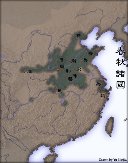
Extent of urbanisation in Spring and Autumn Period China. Based on "The spread of cities in China during the Spring and Autumns period" in Cultural Atlas of China. The first capital city of selected states are marked.
Created and copyright (2004) by Yu Ninjie. Released under the GNU FDL.
The originally picture is located at Image:Chunqiu map.jpg.
The Classical Chinese Modification is made by User:Itsmine.
Yeu Ninje from en.wikipedia.org, the copyright holder of this work, hereby publishes it under the following license:

|
根據自由軟體基金會發佈嘅無固定段落、封面文字同封底文字GNU自由文件授權條款第1.2或打後嘅版本,你獲授權可以重製、散佈同埋修改爾份文件。授權條款嘅副本喺章節GNU自由文件授權條款。 |
| 呢個檔案用共享創意 姓名標示-非商業性-相同方式分享3.0 未本地化版本條款授權。 | ||
| 姓名標示: Yeu Ninje | ||
| ||
| This licensing tag was added to this file as part of the GFDL licensing update. |